
Alaska 2008
Tok, AK to Healy, AK
9 July 2008
Route Map
Destination Map
Route Information
City/Town |
Points of interest |
Distance From |
Miles/Km |
Waypoint |
State/ |
Highway |
|---|---|---|---|---|---|---|
| Tok, AK* | Tok RV Village | Home Healy |
4861/7778 315/504 |
63.334 N 142.964 W |
AK |
|
| Delta Junction, AK* | Home Tok Healy |
4959/7950 108/173 207/331 |
64.038 N 145.733 W |
AK | AK 2 (End Alaska Highway) AK 4 (Begin Richardson Highway) |
|
| Big Delta, AK* | Home Tok Healy |
4978/7965 117/187 198/317 |
64.153 N 145.843 W |
AK | AK 2 (Richardson Highway) |
|
| North Pole, AK* | Home Tok Healy |
5050/8080 189/302 126/202 |
64.754 N 147.339 W |
AK | AK 2 | |
| Fairbanks, AK* | Home Tok Healy |
5063/8101 202/323 113/181 |
64.820 N 147.712 W |
AK | AK 2 AK 3 (Parks Highway) |
|
| Ester, AK* | Home Tok Healy |
5073/8117 212/339 103/165 |
64.844 N 148.007 W |
AK | AK 3 | |
| Nenana, AK* | Home Tok Healy |
5117/8187 256/414 59/94 |
64.559 N 149.096 W |
AK | AK 3 | |
| Healy, AK* | Denali RV Park & Motel | Home Tok |
5176/8282 315/504 |
63.822 N 148.987 W |
AK | AK 3 |
| Denali National Park | ||||||
| *Fuel Available |
Photographs and Commentary
Click on pictures to enlarge
So what do you expect after a night of rain in Alaska... more rain. We were lucky that it didn't rain when we got the trailer ready for the road because shortly after we go on the Alaska Highway it started to rain, heavily at times. As we moved north towards Delta Junction and then on to Fairbanks, we did have some bright gray spots and off to the southwest, we could see a hint of blue. If you look at the route map you see that we drove northwest to Fairbanks and then headed southwest to Healy and Denali National Park. By the time we got a few miles out of Fairbanks, the sky began to clear and we wound up with a temperature in the low 60s. Instead of rain, we got a strong headwind with some serious gusts. When we set up the trailer in the campground you could feel it shaking.
Our route took us up the Alaska Highway to its "official" end in Delta Junction where it intersects with the Richardson Highway. The town of Delta Junction contends that the end of the highway is at the junction of the Richardson and Alaska Highways. They base their claim on the fact the Richardson Highway already existed before the construction of the Alaska Highway. Others contend that the end of the Alaska Highway is in Fairbanks. In any event, the 100 miles from Tok to Delta Junction were really easy. As we left the Tok town limits, we saw a sign that said, "End Construction." While the road still had its rough spots, it was a dream compared to what we encountered yesterday. At Delta Junction we picked up the Richardson Highway and drove another 100 miles to Fairbanks. Road conditions were good with a couple of small construction zones and one major project near North Pole that required us to detour onto what seemed to have been a service road. None of these projects delayed us for more than a few minutes. For most of its length the Richardson Highway follows the Tanana River. We could see of the river through the rain and mist. There was no point in even trying to take a picture. Click to see a picture taken in 2005.
As we passed Eilson Air Force Base, south of Fairbanks, we could see fighters taking off on the runway that paralleled the highway. There are large signs advising no stopping and no photography There was a US Air Force Police vehicle in front of us as we were passing the runway area. We noticed a man parked on the southbound side of the road taking pictures. We wondered why the police didn't stop when the flashing lights came on and the police made a U-turn and headed for the guy with the camera. You have to wonder how dumb people could be... there was plenty of warning and the man stopped anyway.
In Fairbanks we picked up the Parks Highway, which took us southwest to Healy. The highway climbs out of Fairbanks and we should have gotten a view of the Tanana Valley from the other side. There are some long climbs and downgrades on this highway which didn't help our fuel economy (the wind was not a plus either). Eventually the road follows the Nenana River valley into Healy. The Parks Highway did have one construction zone that required a pilot vehicle escort. Again, this delay was minimal.
After setting up the trailer in the campground and having lunch, we headed eight miles south to Denali National Park. We have reservations for an excursion into the park tomorrow and wanted to get our tickets in advance. We didn't spend much time there today as we have the excursion tomorrow and another day during which we plan to do some independent sightseeing in the park and surrounding area.
For those of you who read the book, Into the Wild or seen the movie, the town of Healy may mean something to you. This is the area where Chris McCandless met his end. He had hiked 20 miles west "into the wild" from the Parks Highway on the outskirts of Healy. For those who have not read the book by Jon Krakauer, I have included a link to the Outside Magazine article Krakauer wrote in January 1993 prior to writing the book
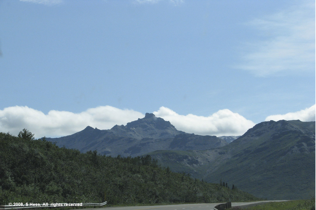
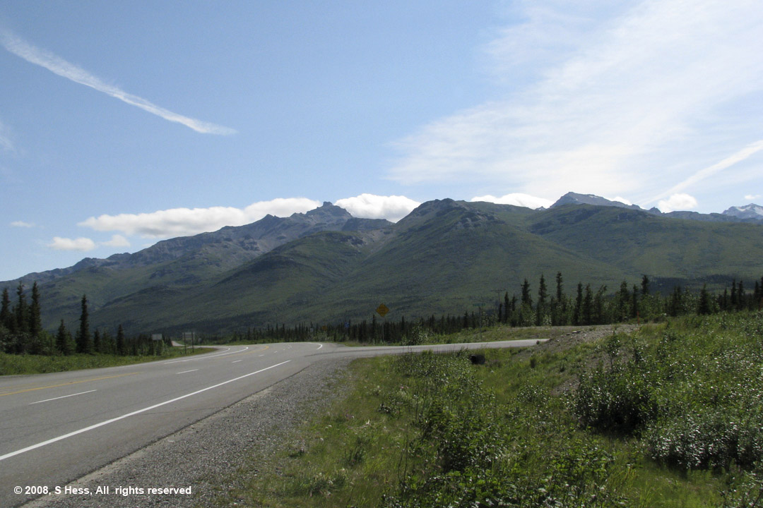
Parks Highway Scenes
Pictures by Susie
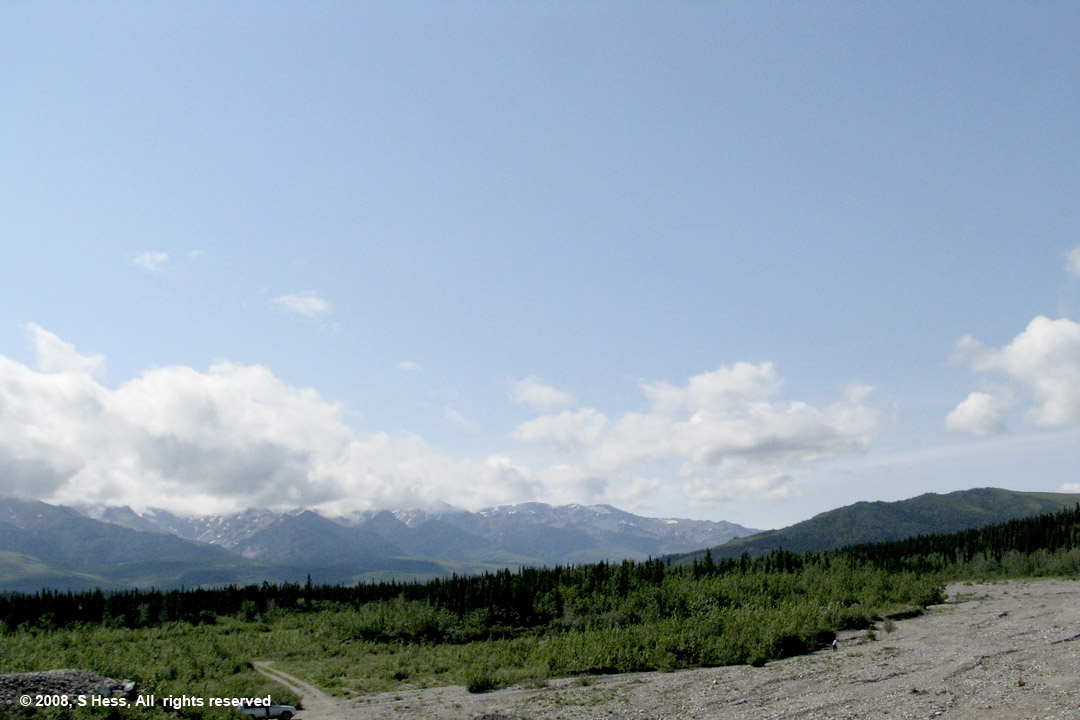
First view of the Alaska Mountain Range from Parks Highway


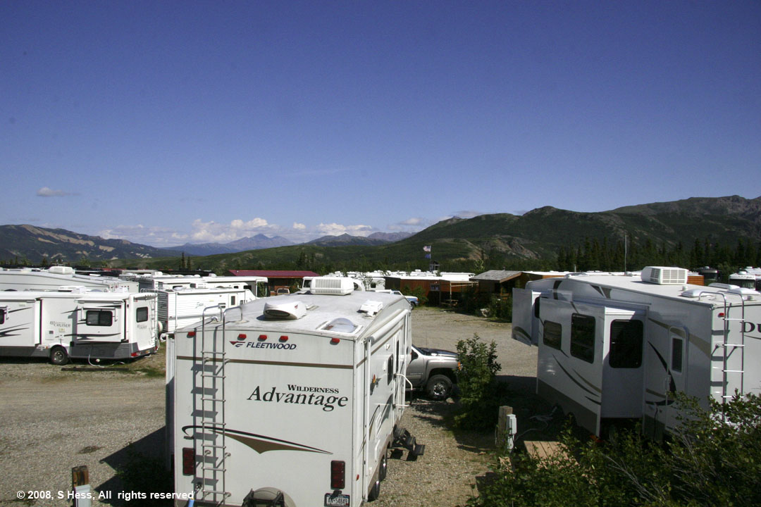
View of the campground from a rise behind our trailer (foreground)
photograph by Sam
Seen on the Road
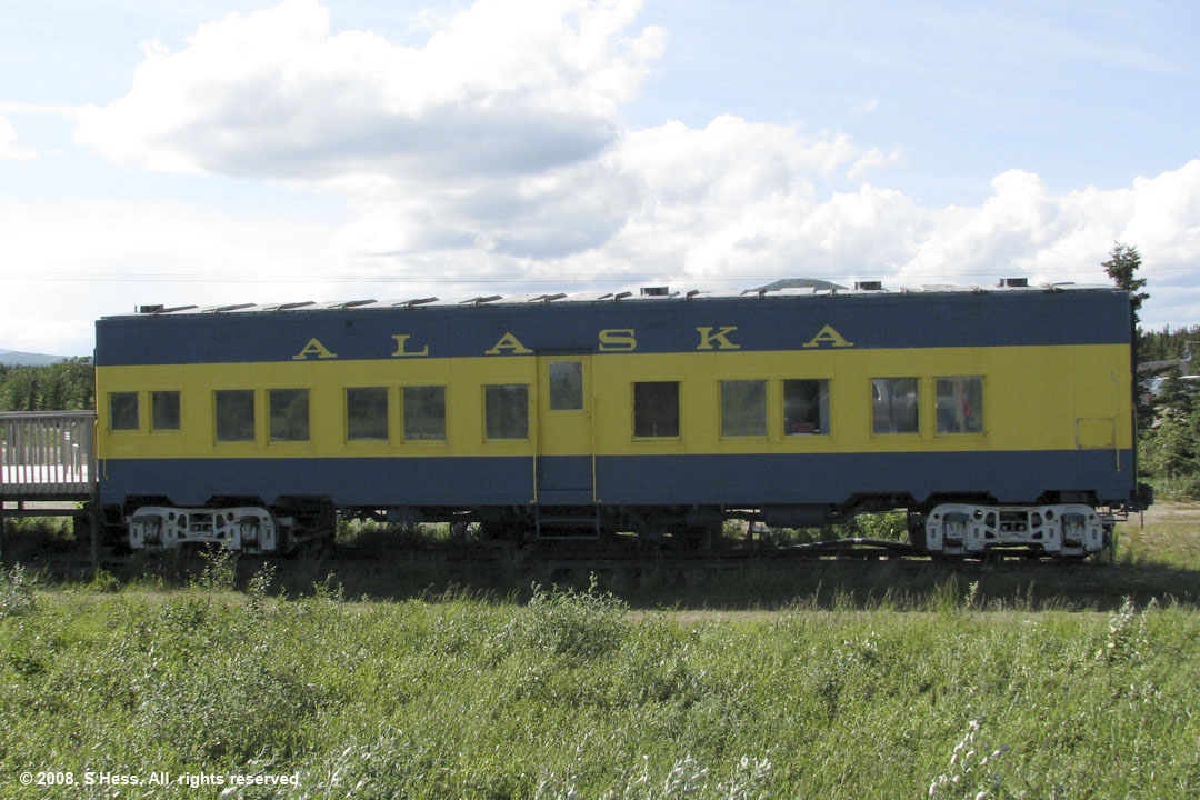
This railroad car is one of three in the Denali Park Hotel. This one and its companion are located on the edge of the property facing the Parks Highway. We don't know if they are used as rooms or as restaurant space. They didn't look like they were in use when we passed. Photograph by Susie.