
Alaska 2008
Watson Lake, YT to Fort Nelson, BC
28 July 2008
Route Map
Destination Map
Route Information
City/Town |
Points of interest |
Distance From |
Miles/Km |
Waypoint |
State/ |
Highway |
|---|---|---|---|---|---|---|
| Watson Lake, YT* | Downtown RV Park | Home Fort Nelson |
7161/11458 317/507 |
60.063 N 128.705 W |
YT |
YT 1 (Alaska Highway) |
| Contact Creek, YT* | Home Watson Lake Fort Nelson |
7202/11523 41/66 276/442 |
60.007 N 127.770 W |
YT | YT 1 | |
| Fireside, BC* | Home Watson Lake Fort Nelson |
7245/11592 84/134 233/373 |
59.663 N 127.141 W |
BC | BC 97 (Alaska Highway) |
|
| Liard River, BC* | Liard Hotsprings Provincial Park | Home Watson Lake Fort Nelson |
7291/11666 130/208 187/299 |
59.418 N 126.094 W |
BC | BC 97 |
| Muncho Lake, BC* | Muncho Lake Provincial Park | Home Watson Lake Fort Nelson |
7330/11728 169/270 148/237 |
58.948 N 125.769 W |
BC | BC 97 |
| Toad River, BC* | Home Watson Lake Fort Nelson |
7364/11782 203/325 114/182 |
58.834 N 125.196 W |
BC | BC 97 | |
| Summit Lake, BC* | Home Watson Lake Fort Nelson |
7383/11813 222/355 95/152 |
58.705 N 124.878 W |
BC | BC 97 | |
| Junction Liard Highway | Home Watson Lake Fort Nelson |
7461/11938 300/480 17/27 |
58.890 N 123.142 W |
BC | BC 97 | |
| Fort Nelson, BC* | West End RV park | Home Watson Lake |
7478/11965 317/507 |
58.805 N 122.722 W |
BC | BC 97 |
| Fort Nelson Heritage Museum | ||||||
| *Fuel Available |
Photographs and Commentary
Click on pictures to enlarge
We are early birds and like to leave the campgrounds early and arrive at our destination by mid-afternoon. So when we got up around 5:30 AM, it was to a cool 37° F. It was not as bad as it sounds, since the sun was shining and that warmed us up a bit. Of course, we had the heater set to about 69° to get rid of that chill. By the time we arrived at Fort Nelson, the temperature had reached 72° and we took off our Polartech tops and walked around in T-shirts. It felt great as it was the first time we saw anything over the mid 60s in nearly a month. The forecast for tonight at Fort Nelson is for a low of 54°, a temperature we had gotten accustomed to as a high.
When they laid out the Alaska Highway during the early days of World War II, they followed the path of least resistance because they needed to get the 1400 mile route completed in record time. The road has been reconstructed several times since then but it still follows the path of least resistance. The first 100 miles or so of the route follows the Liard River Valley. At times we are along side the river and other times we are riding ridge lines well above it. This makes for a road that twists, climbs and drops on grades as high 9%.
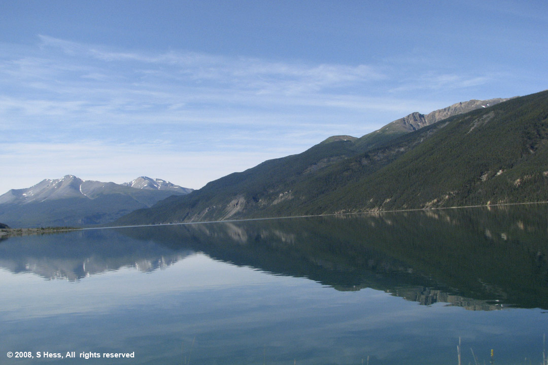
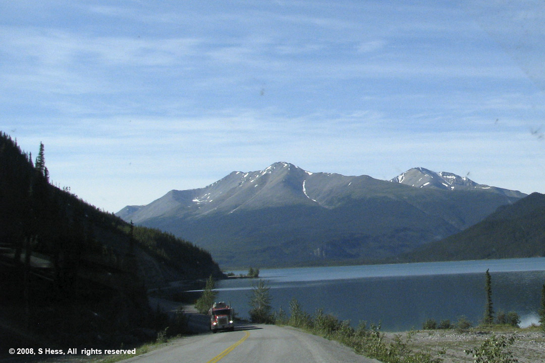
About half way through our journey today we came to Muncho Lake Provincial Park and Muncho Lake itself. On our last trip up the Alaska Highway we were told that Muncho Lake marks the northern end of the Rocky Mountains. The mountains to the north are part of a different chain. I don't know why that particular spot marks the end because the mountains immediately to the north of the lake don't look any different to me. We had stopped at Muncho Lake for several days on our last trip and it was probably the most beautiful spot we had stayed in (if you didn't mind the cloud of mosquitoes). As we passed by Muncho Lake we noticed that the campground we stayed in, an adjacent motel and another campground were shut down. It seems like the two Provincial campgrounds and one Lodge are all that are operating at this time and I have my doubts about the lodge. These are apparently victims of the slow down in tourism due to the high cost of fuel. The highway segment that runs along the lake was one of the most difficult segments to build. Steep mountains come right down to the lake and they had to blast parts of them down to make a roadbed.
After passing Muncho Lake the road continues to twist and climb in, out and above a number of valleys. At times the valleys are so narrow that you are "between a rock and a wet place," a steep rock face on one side of the road and a river on the other with almost no room for a shoulder. About 50 miles north of Fort Nelson, the hills become more gentle and the valleys wider so that the road ceases to curve and climb much.
The last time we drove this segment we saw more wildlife than we had on any other road segment. The same was true for today's ride. We saw Black Bear, Moose, Caribou, Stone Sheep, Red Fox, Buffalo, Snowshoe Hare and a few more squirrels. Susie, who was ever ready with a camera, couldn't move fast enough and I couldn't slow down fast enough to capture pictures of all the animals, but she managed to get some great pictures, below.
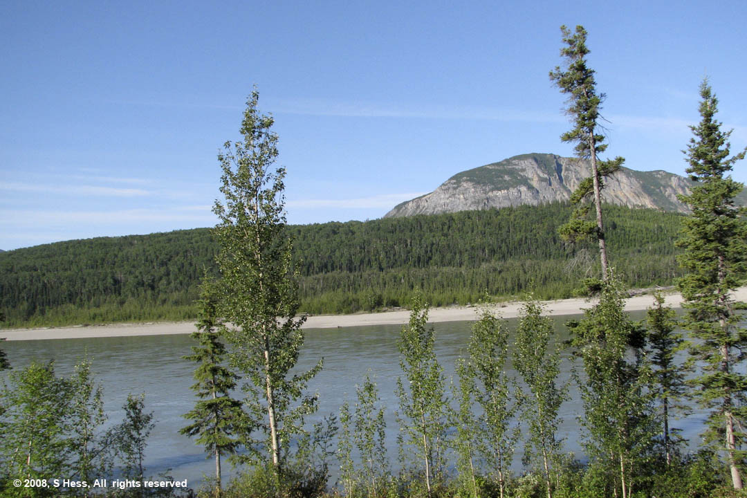
Liard River
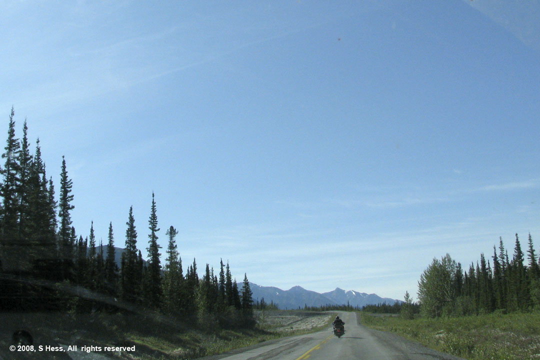
The Alaska Highway north of Muncho Lake. In 300 miles of driving we were only passed by two cars and this motorcycle... that's being alone.
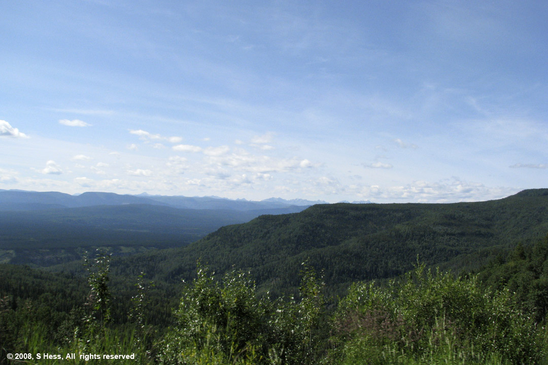
Muskwa River Valley with the Rockies in the background
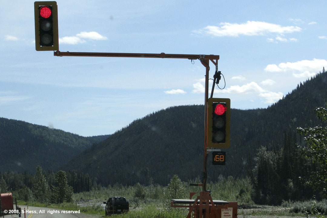
This was a high tech traffic control that was not well thought out. Workers were burying fiber optic cable and restricted the road to a single lane controlled by this device. The people who designed this didn't think there would be any delays greater than 99 seconds and only equipped it with a two digit display. When it got down to near zero and no opposing traffic, I started the engine only to see the counter start at 99 seconds again.
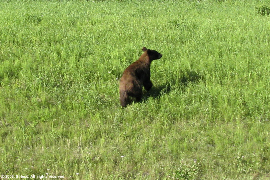
Black Bear
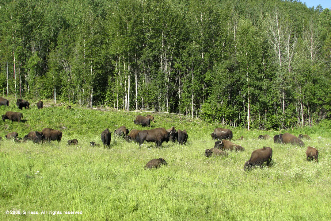
A herd of Buffalo grazing alongside the highway
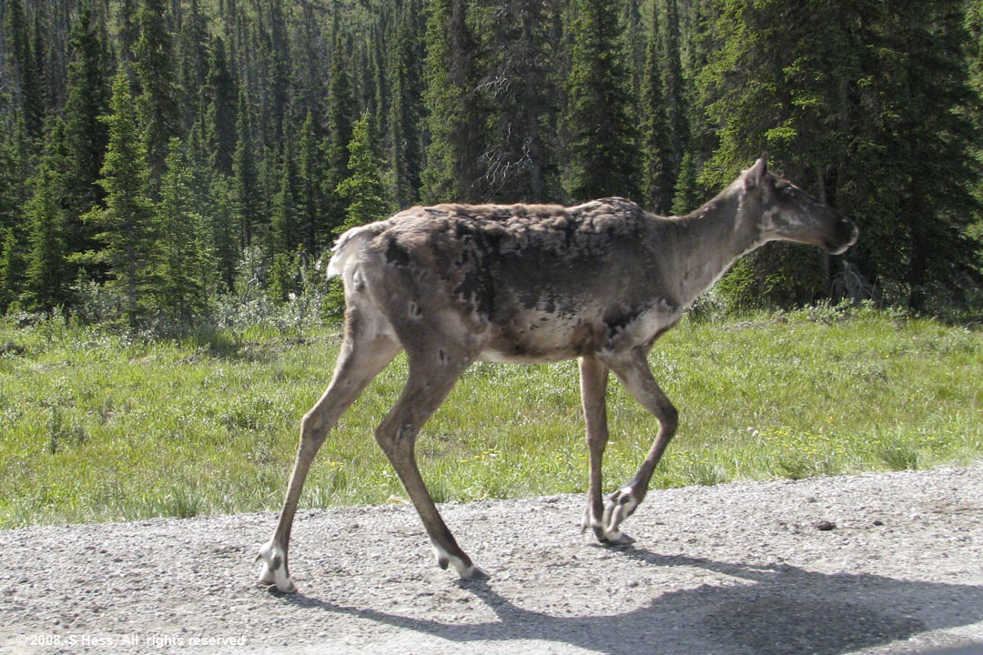
Caribou
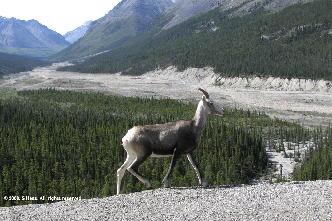
Stone Sheep