For a variety of reason we missed some photo opportunities today, but we will stop on the return trip to take additional pictures of the route. The design of the Alaska Highway doesn't make it easy to photograph the many scenic views or animals we encountered. The highway is two lanes with a shoulder on both sides that is barely wide enough for a car. Frequently the shoulders end in a drop. There are few rest areas or viewing areas along the highway in British Columbia and it seems that the Yukon has a few more. It can be very dangerous to pull over onto the shoulder with the truck and trailer because we may be partially in the road. Pulling over further may cause us to roll over into a ditch. Despite this, we find people stopping on the highway to get a picture of an animal or a view. According to the guidebooks, this has been the cause of numerous accidents on the highway.
Today's trip also had us crossing the Continental Divide. For those unfamiliar with the Divide, it is the point in the western mountains where the watersheds switch directions. A drop of water falling on the eastern side of the Divide will, in this part of North America, flow east and north to the Arctic Ocean. A drop falling on the western side will flow west and north to the Bering Sea or west and south to the Gulf of Alaska and the Pacific Ocean.
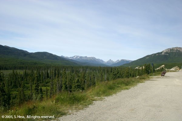


The mountain in the background is Simpson Peak