
Alaska 2008
Haines Junction, YT to Watson Lake, YT
27 July 2008
Route Map
Destination Map
Route Information
City/Town |
Points of interest |
Distance From |
Miles/Km |
Waypoint |
State/ |
Highway |
|---|---|---|---|---|---|---|
| Haines Junction, YT* | Kluane RV Kampground | Home Watson Lake |
6794/10870 367/587 |
60.753 N 137.510 W |
YT | YT 1 |
| Otter Falls Cutoff* | Home Haines Junction Watson Lake |
6814/10902 20/32 347/555 |
60.854 N 137.032 W |
YT | YT 1 | |
| Whitehorse, YT* | Home Haines Junction Watson Lake |
6892/11027 98/157 269/430 |
60.685 N 135.060 W |
YT | YT 1 YT 2 (Klondike Highway) |
|
| Jakes Corner, YT* | Tagish | Home Haines Junction Watson Lake |
6940/11104 146/234 221/354 |
60.340 N 133.984 W |
YT | YT 1 |
| Johnsons Crossing, YT* | Home Haines Junction Watson Lake |
6968/11149 174/278 193/309 |
60.482 N 133.307 W |
YT | YT 1 | |
| Teslin, YT* | Home Haines Junction Watson Lake |
7000/11200 206/330 161/258 |
60.168 N 132.708 W |
YT | YT 1 | |
| Swift River, BC* | Home Haines Junction Watson Lake |
7054/11286 260/416 107/171 |
59.890 N 131.385 W |
BC | BC 1 | |
| Rancheria, YT* | Home Haines Junction Watson Lake |
7080/11328 286/458 81/130 |
60.081 N 130.813 W |
YT | YT 1 | |
Junction Cassiar Highway/Alaska Highway* |
Home Haines Junction Watson Lake |
7148/11437 354/566 13/21 |
60.027 N 129.061 W |
YT | YT 1 YT 37 (Cassiar Highway) |
|
| Watson Lake, YT* | Downtown RV Park | Home Haines Junction |
7161/11458 367/587 |
60.063 N 128.705 W |
YT | YT 1 |
| Sign Post Forest | ||||||
| *Fuel Available |
Photographs and Commentary
Click on pictures to enlarge
We had a cold start this morning. When I first got in the truck I thought we had frost on the windshield... it was not. The temperature at Haines Junction was 35°F. It stayed in the 40s for quite some time until the sun started breaking through the haze. As I write this the temperature in Watson Lake has reached 64° under partly cloudy skies. This is the warmest we have been in some time.
The run from Haines Junction to Watson Lake was an easy one. We only had to go through one construction area and it was shut down for the weekend, so we had no delays. We had covered most of today's route on the way up to Alaska so we didn't take any pictures on the road. The thin overcast made for less than ideal photography. The only part of today's journey we didn't cover on the way north was the last 15 miles into Watson Lake. The only unusual sighting we had was just five miles out from Haines Junction where we saw a grizzly bear on the side of the road. In the thousands of miles we have traveled up here in the two trips we had never seen a grizzly before. The only other animals we saw today were suicidal ground squirrels that kept running across the road in front of us. We stopped counting them after a while.
Watson Lake's most famous attraction is the Sign Post Forest. When we went through Watson Lake in 2005 we brought an Alderton Street Sign to place in the forest. Our campground is walking distance from the Sign Post Forest so we went there shortly after we had set up the trailer. We both thought we knew where our sign was and started looking for it. Our recollection was that our sign was in one of the outer rows of signs on the east side of the forest. We were right, they were in the outer rows... in 2005. Quite a few more rows were added since 2005 and our sign and its post were no longer on the outside. Eventually we found the sign (see below).
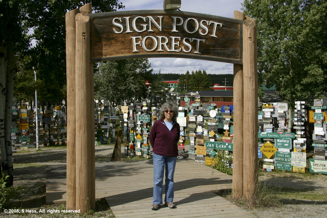
Susie at the entrance to the Sign Post Forest in Watson Lake, Yukon
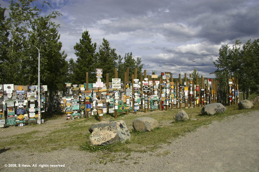
This is but a small sampling of the signs from all over the world that can be found at the Sign Post Forest
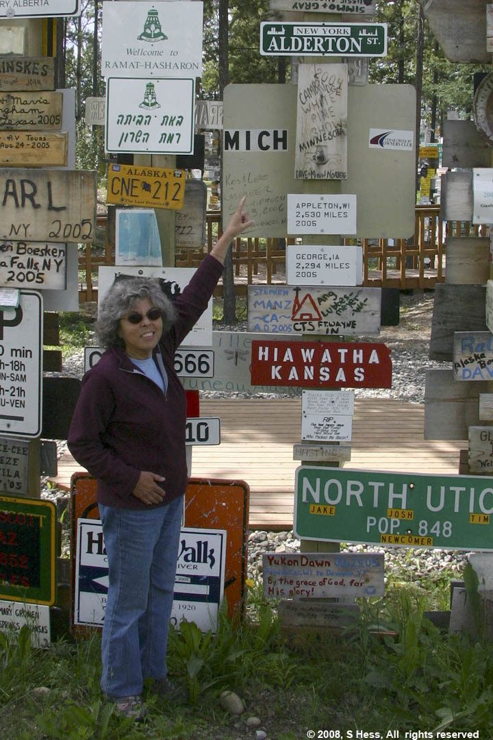
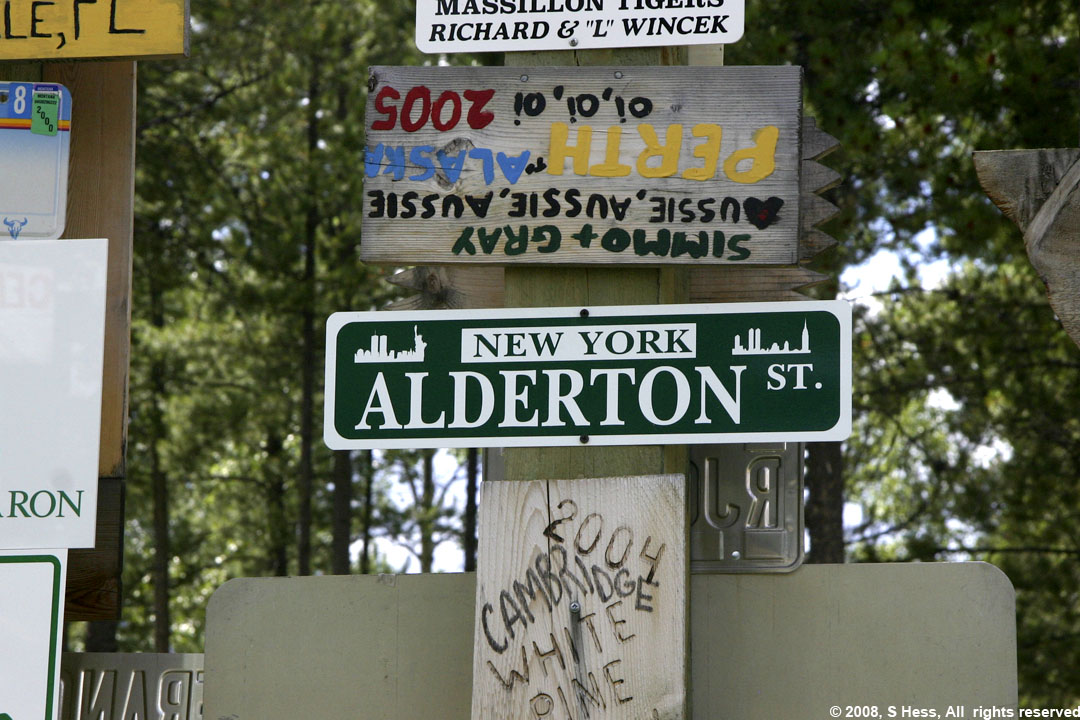
Left, Susie pointing at the Alderton Street sign we hung in 2005. Close up, above.