
Alaska 2008
Lethbridge, AB to Jasper, AB
25 June 2008
Route Map
Destination Map
Route Information
City/Town |
Points of interest |
Distance From |
Miles/Km |
Waypoint |
State/ |
Highway |
|---|---|---|---|---|---|---|
| Lethbridge, AB | Bridgeview RV Resort | Home Jasper |
2549/4078 390/624 |
49.706 N 112.873 W |
AB |
AB 4 AB 5 AB 3 |
| Calgary, AB | Home Lethbridge Jasper |
2684/4294 135/216 255/408 |
51.067 N 114.026 W |
AB | AB 2 AB 1 |
|
| Banff, AB | Banff National Park | Home Lethbridge Jasper |
2762/4419 213/341 177/283 |
51.193 N 115.564 W |
AB | AB 1 |
| Lake Louise | Home Lethbridge Jasper |
2797/4475 248/397 142/227 |
51.426 N 116.173 W |
AB | AB 1 | |
| Icefields Parkway | ||||||
| Columbia Icefield | ||||||
| Athabasca Falls | ||||||
| Jasper, AB | Jasper National Park | Home Lethbridge |
2939/4702 390/624 |
52.857 N 118.080 W |
AB | AB 93 AB 93A (Icefields Parkway) AB 16 (Yellowhead Highway) |
| Jasper Tramway/ Whistler's Mountain |
Photographs and Commentary
Click on pictures to enlarge
Today was a run of nearly 400 miles, about two-thirds of the route was on four lane highways. We passed through some small, one traffic light, towns until we got to the outskirts of Calgary. There was construction activity as we got into town and this slowed traffic a bit. In Calgary, we turned west on TransCanada Highway 1. WIthin the city limits of Calgary, TC-1 runs on city streets which also had some construction. Once west of Calgary city limits, TC-1 becomes a limited access highway and starts heading into the Rockies. A few miles northwest of Banff, you come to a toll barrier where we had to pay for a permit to enter the park... anyone traveling within the confines of Banff and Jasper National Park is required to pay this fee.
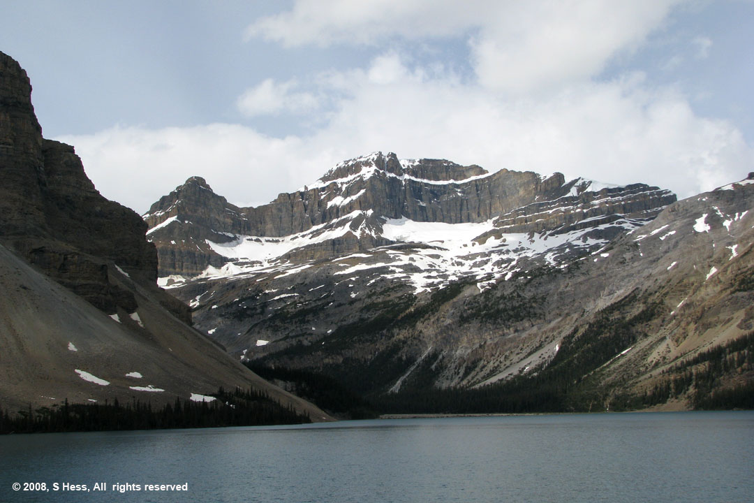
About twenty minutes after the toll booth, we left TC-1 and headed north on the Icefields Parkway. This is one of the most beautiful roads we have ever driven (this is our second time). The route runs, as the park literature states, "up the spine of the Rockies." You are surrounded by towering, jagged peaks. The road climbs at least two passes that exceed 6,000 feet in elevation. Many of this mountains have glaciers hanging on them. About 60 miles south of Jasper you come upon the Columbia Icefield. The most visible glacier that is a part of the Columbia Icefield is Athabasca Glacier, which feeds the Athabasca River. Two other major rivers are born in the Columbia Icefield, the Columbia River and the North Saskatchewan River. This makes the area of the Columbia Icefield a tri-continental divide with the North Saskatchewan water ultimately reaching Hudson's Bay and the Atlantic Ocean, the Athabasca River waters reaching the Bering Sea via the Yukon River and the Columbia River flowing into the Pacific.
The last time we were on the Icefields Parkway, we encountered some mountain goats at the edge of the road. We did not have the trailer in tow so we pulled over to get some pictures. One of the other people that stopped to take pictures was a local resident who told us that in years of traveling on the Parkway she has never encountered mountain goats that near the road. Today, we spotted a lone Bighorn Sheep on the edge of the road. Bighorns, like the mountain goats, usually stay up in the mountains where their predators have more difficulty getting at them. The mountain goats were licking salts on the edge of the road and I assume that the Bighorn Sheep was doing the same. Unfortunately, we had the trailer in tow and no place to pull over so we could not photograph the Bighorn.
We learned a good lesson about fuel economy today. Even though about 40% of our trip was through mountainous terrain and we had some heavy city traffic, our fuel consumption rate improved by more than 20%. I attribute most of the improvement to the fact that our speed was kept at 65 MPH or less. We started driving below the speed limit a few days ago and didn't seem to get much benefit out of it. Part of our problem was that we had pretty strong head winds. When you are pulling a trailer that presents a surface measuring approximately nine by eight feet, you get a lot wind resistance even without head winds. Today was the first day since we left Wisconsin that the winds have not been a factor. For the rest of the trip we plan to keep our speed at a maximum of 65 MPH.
Icefields Parkway

Picture by Susie

Picture by Susie
Picture by Susie


Picture by Susie
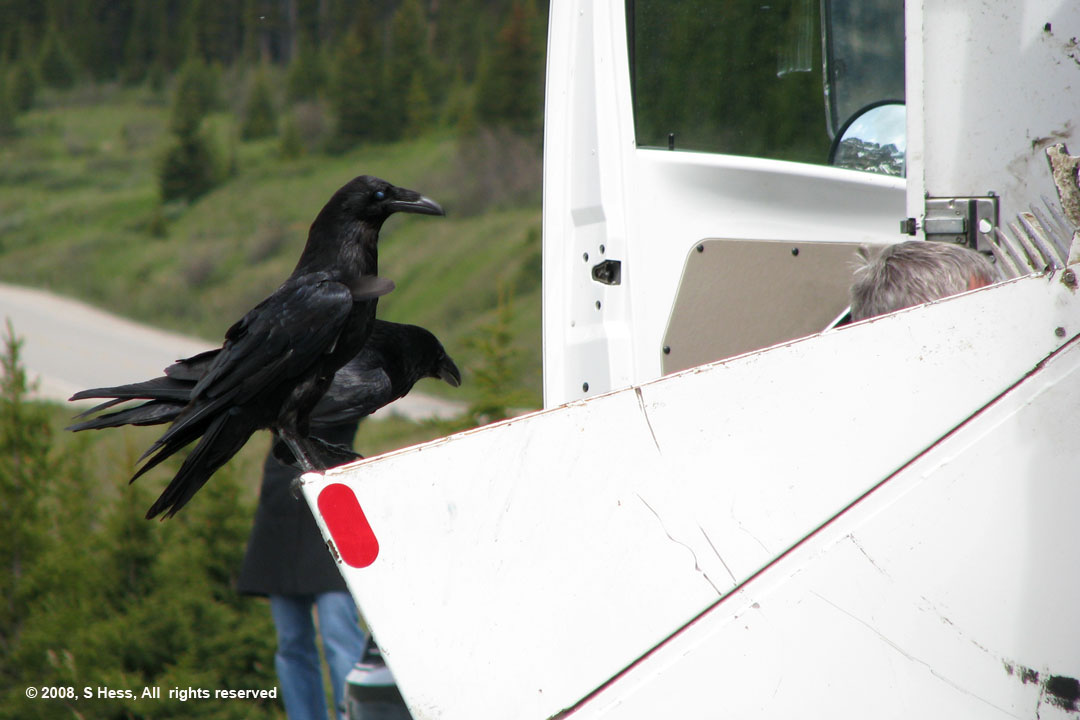
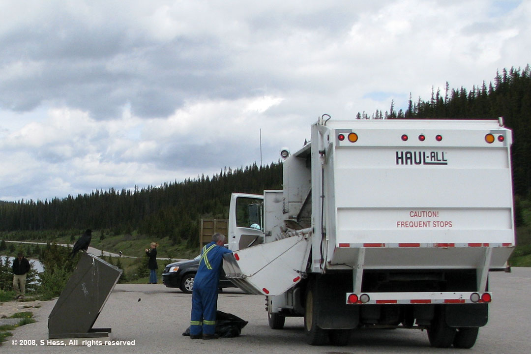
The garbage collector was emptying the animal proof garbage containers and the crows were waiting for a free meal. Every time he walked away or even looked away, they were at the truck looking for goodies. The picture at right shows how unafraid they are... you can see the top of the collector's head just above the hopper.