
Summer 2009
Albuquerque, NM to Page (Lake Powell), AZ
7 June 2009
Route Map
Route Information
City/Town |
Points of interest |
Distance From |
Miles/Km |
Waypoint |
State/ |
Highway |
|---|---|---|---|---|---|---|
| Albuquerque, NM | Home Page, AZ |
2566/4106 462/739 |
N 35.0721 W 106.5094 |
NM | I-40 US-66 |
|
| Gallup, NM | Home Albuquerque, NM Page, AZ |
2712/4339 146/234 263/421 |
N35.5284 W 108.7599 |
NM | I-40 US-491 |
|
| Flagstaff, AZ | Home Albuquerque, NM Page, AZ |
2891/4626 325/520 137/219 |
N 35.2181 W 111.5838 |
AZ | I-40 US-89 |
|
| Page, AZ | Wahweap Lodge & Marina/RV Park | Home Albuquerque, NM |
3028/4845 462/739 |
N 36.9908 W 111.4948 |
AZ | US-89 |
| Glen Canyon National Recreation Area | ||||||
| Antelope Canyon | ||||||
| Rainbow Bridge National Monument |
Photographs and Commentary
Click on picture to enlarge
We got up this morning to a temperature of 63 degrees, warmer than yesterday but still cool for the is area. The winds seemed to have calmed down so we figured we would do better on our fuel consumption than we did yesterday. Our route took us west out of the Rio Grande Valley. As you start to climb out of the valley you can see three extinct volcanoes and the remnants of lava flows. Once out of the valley we seemed to climb from one plateau to another with mesas rising around us. I-40 travels through the territory of several Native American groups, among them Isleta Pueblo, Acoma Pueblo and Zuni. All of these groups operate casinos and have signs off the road to get you to leave some of your money... we declined the invitations. The winds were still hitting us almost head on and were still affecting our fuel consumption rate. They had picked up a bit once we got west of Grants and produced a fuel consumption rate of 9.4 miles per gallon... nearly 50% better than yesterday.
As you approach Flagstaff, you can see the mountains that give this elevated desert community a ski area. The mountains come into view over 60 miles away. At Flagstaff, we left I-40 and headed north on US-89. This road starts climbing up over the mountains just outside of Flagstaff. Over the next 140 miles we climbed over several passes, ranging up to 7,000 feet. About 30 miles south of Page, US-89A splits from US-89 and heads over to the North Rim of the Grand Canyon, a trip we have planned for Wednesday. At this point, US-89 starts climbing a winding road that takes us over the last of the passes and into Page and the Lake Powell Recreation Area. When we turned north onto US-89, the winds started giving us some payback for the last three days as they were now hitting us from the rear and "pushing" us a bit. Our fuel consumption rate for the run from Flagstaff to Lake Powell was 11.2 miles per gallon. Hopefully, the winds will push us all the way back to New York.
Lake Powell National Recreation Area is the furthest west we will be travelling this trip (not including the run to the North Rim of the Grand Canyon). This is a beautiful area we had talked about visiting for many years. The campground sits on a a ridge overlooking the lake, the marinas and the Wahweap Lodge. This whole area is the National Recreation Area is relatively new. This area was undeveloped until the Glen Canyon Dam was built. Construction of the dam began in 1956 and started generating power ten years later. The town of Page was incorporated in 1957. Lake Powell did not reach its full level (3,700 feet) until 1980. Lake Powell National Recreation Area was established in 1972. The campground is on a rise above the lake and from here we can see the marina and some of the surrounding mesas... it is beautiful to say the least.
This evening we took a walk to Utah. This is not an impressive feat since the Utah - Arizona border is maybe 100 yards from our campsite. We walked down to the nearest boat launching ramps and took some pictures of the lake.
One of the problems with traveling and trying to maintain this Web site (and one other) is that Internet access is not always available. When it is available, it may not be reliable. Our campsite is located about 100 feet from the repeater for the Internet router and we have nothing between us that should interfere with the signal. Unfortunately, the signal is intermittent and even when it is good, access to the Internet is erratic. I even tried sitting on a bench directly below the antenna and could not get connect with my Web server. My other access option, which I used on two other occasions, is to use my phone as a broadband modem. That option is not available here because the broadband signal is very weak and uploading this page would take forever. Consequently, this page, and perhaps those for the next couple of days may not be uploaded until we get to Gallup, NM
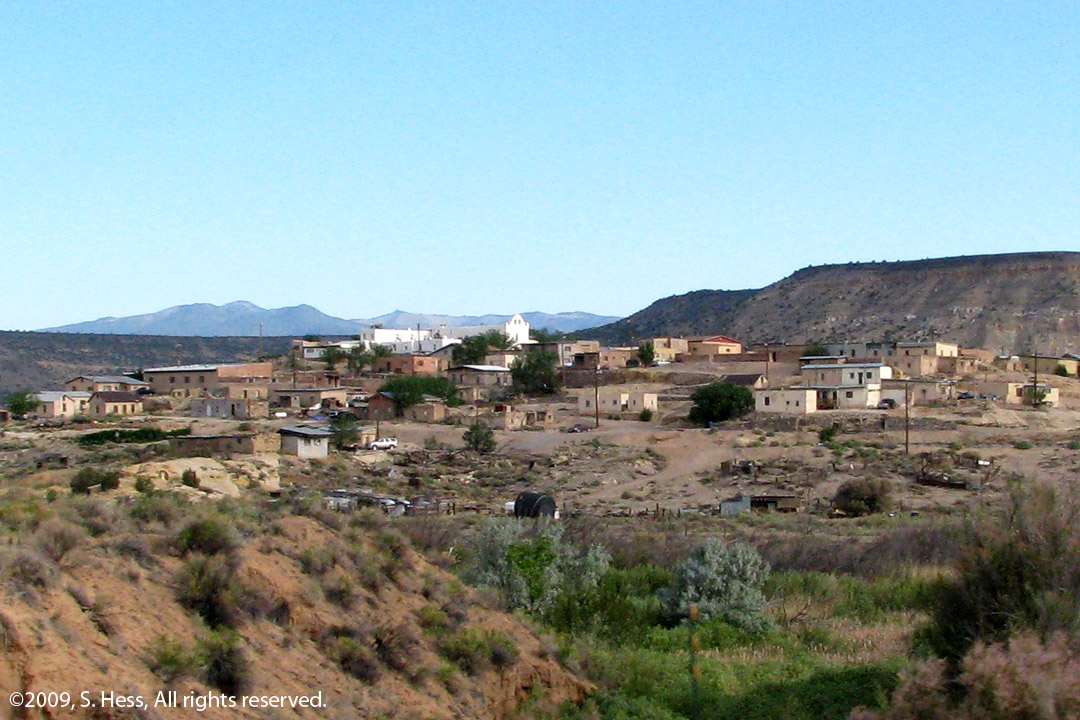
This is part of the Acoma Pueblo (picture by Susie)
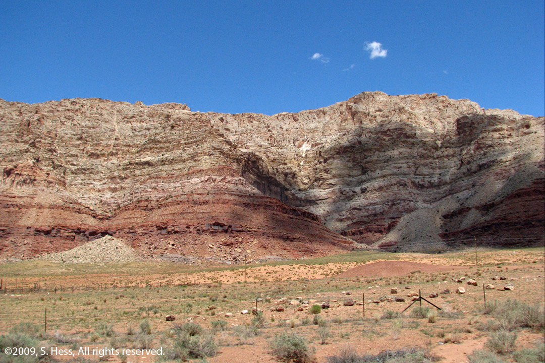
One of the mesas off US 89 (picture by Susie)
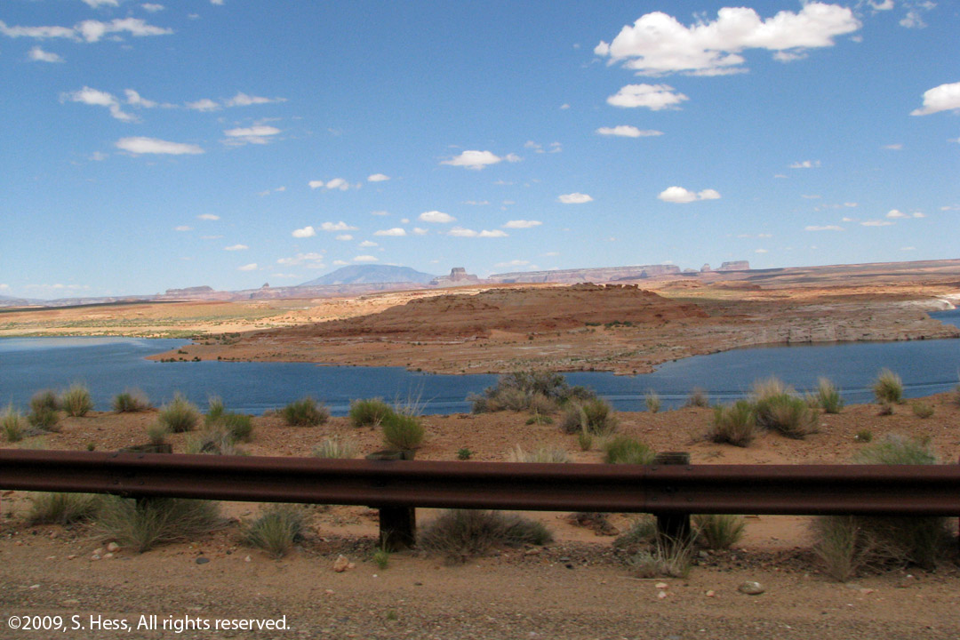
Our first view of Lake Powell (picture by Susie)
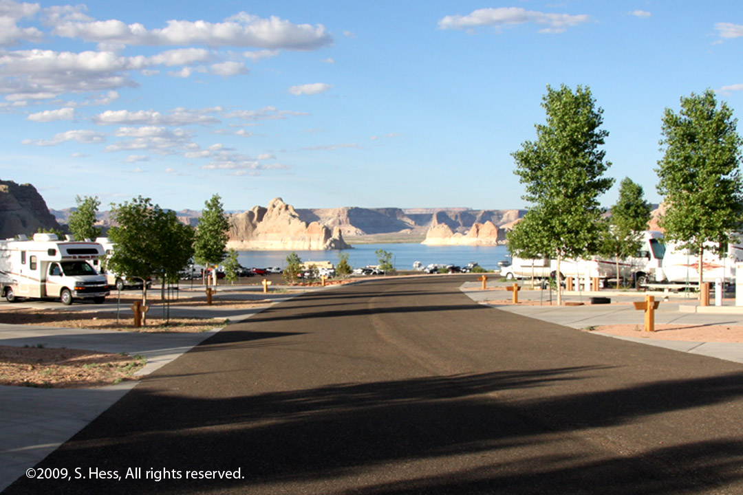
View of Lake Powell from loop D of the Wahweap Campground
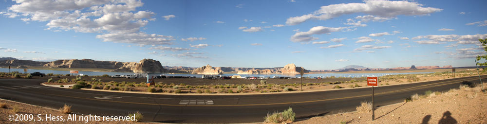
Panorama taken from the Utah - Arizona border
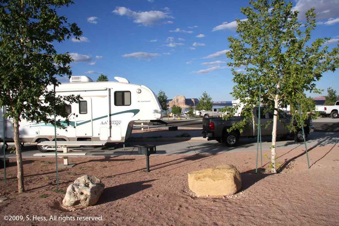
Our trailer with Lake Powell in the background
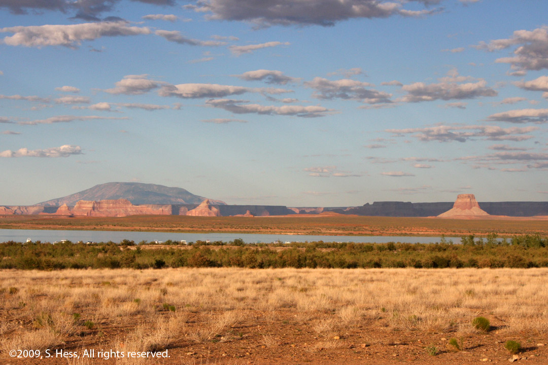
Navajo Mountain (left) and Tower Butte (right)
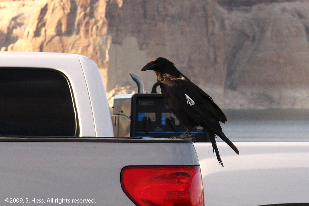
As we were walking at the boat launch parking lot we spotted this raven. He has a white feather on his wing and one on his neck area. This is something we have never seen before.
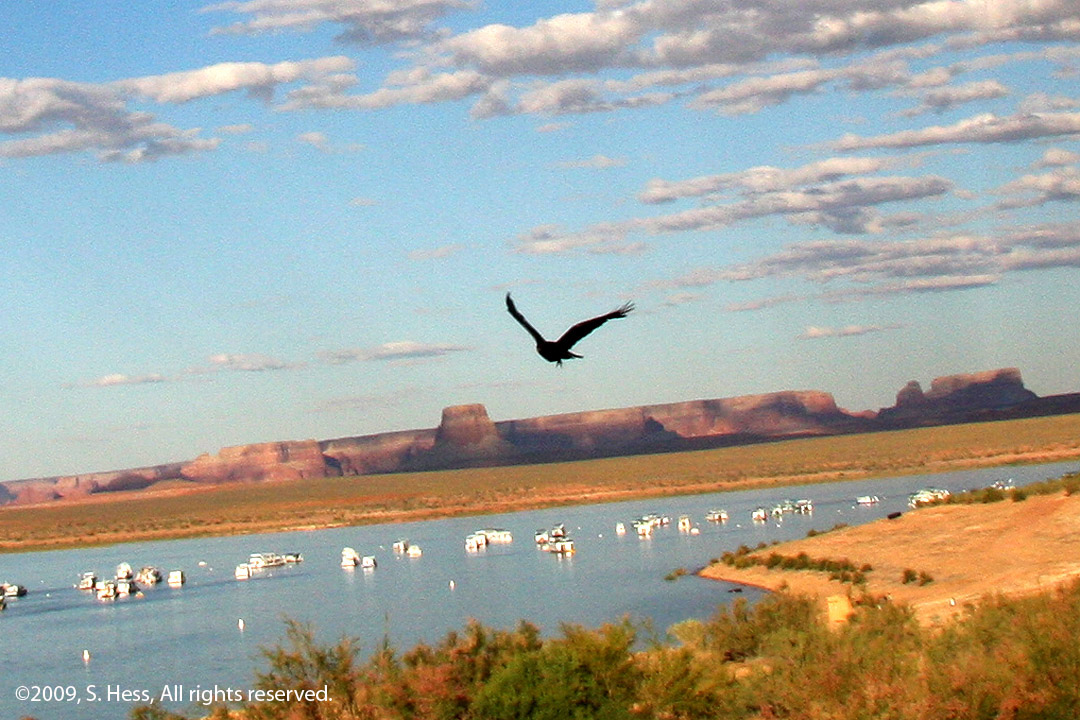
This raven was flying toward us and I didn't have time to aim so I just shot from the hip and got this lucky shot.
Seen on the Road
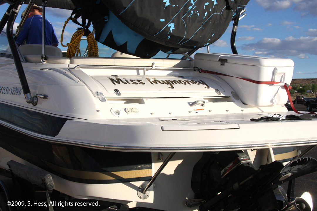
Walking through the parking lot this boat's name caught our eye