
Summer 2009
Page (Lake Powell), AZ
10 June 2009
General Information
Local Map
Photographs and Commentary
Click on picture to enlarge
Today we took a long ride to the North Rim of the Grand Canyon. We had been to the South Rim years ago and heard that the North Rim is even more spectacular. So we drove about 140 miles each way to see it. I would be hard pressed to say which one is more spectacular. Was it worth the ride... certainly.
Our route took us south of the Lake Powell National Recreation Area about 30 miles on US 89. At this point we took US 89A which doubled back north for about 15 miles to Lees Ferry in Marble Canyon on the Colorado River where we made our first stop. To get there we crossed to the right bank (north shore at this point) over the Marble Canyon Bridge. As we crossed the bridge, we spotted a California Condor at just about eye level with us. The Condors are being reintroduced into the area. Lees Ferry has an interesting history which you can find at this link. Lees Ferry is the starting point for for rafting trips on the Colorado River. We spoke to a couple of guides, part of a six raft group, as they were waiting for their clients to arrive for a fourteen day trip on the river. This particular group was using the muscle power of the guides to get downstream. Another option is motorized rafts which are bigger.
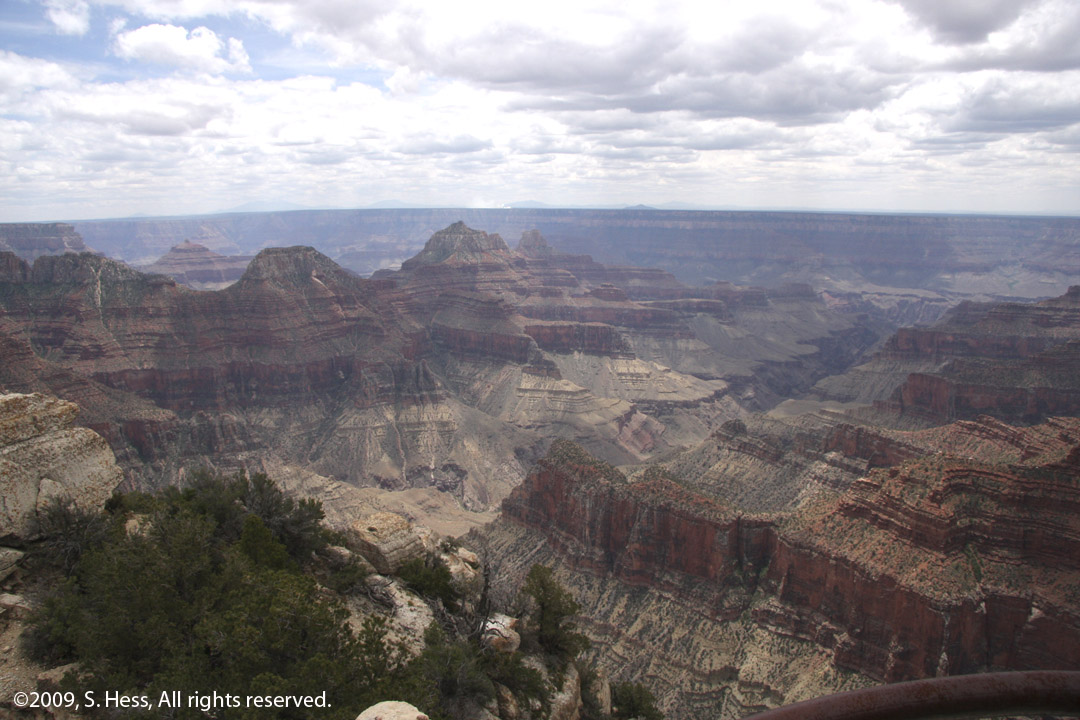
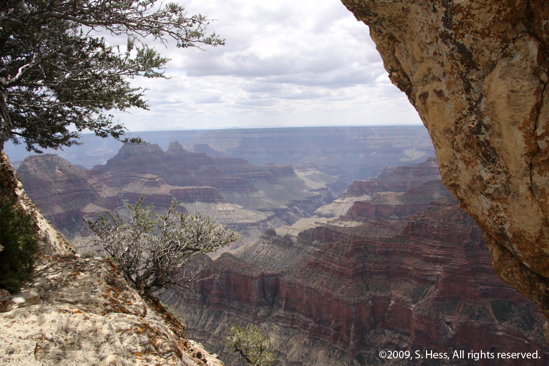
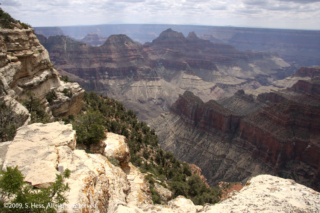
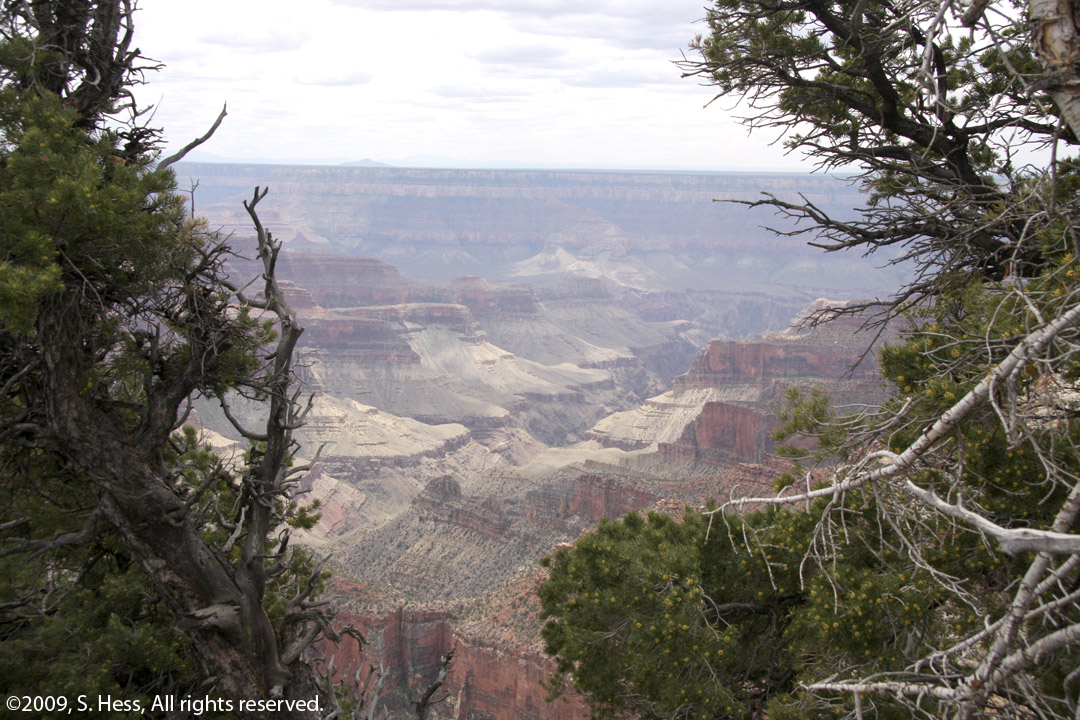
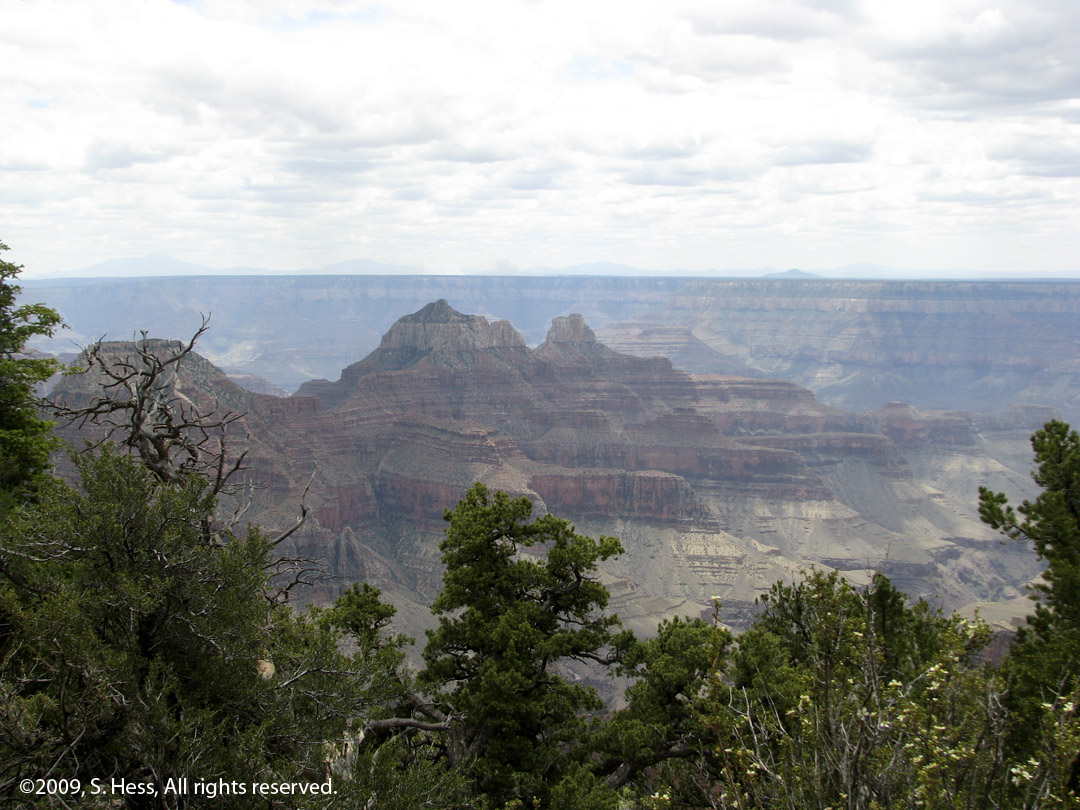
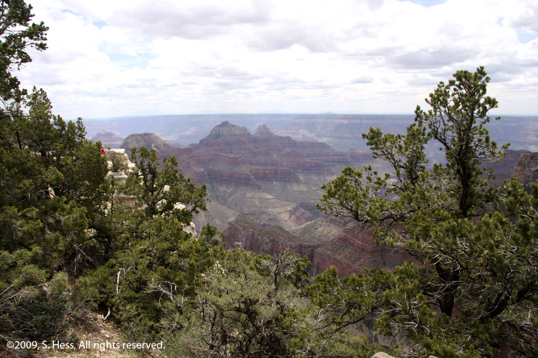
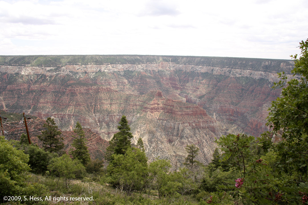
Leaving Lees Ferry, we followed US 89A west along the Vermillion Cliffs for several miles before the highway started climbing up onto the Kaibab Plateau and entering the Kaibab National Forest. The road climbs about 5,000 feet from the high desert. At Jacob's Lake, we picked up AZ 67 for thirty miles to the North Rim. Having limited time at the North Rim, we opted to take a short trail to Bright Angel Point where the photographs of the Canyon were taken. There are a number of other trails that take you to other view points that may well be more spectacular than the Bright Angel point, but they required a lot more time than we had available. As you can see in the pictures below, there is significant haze in the canyon which obscures the view. Some of this may be attributed to nature, but, based on my readings, a good amount of the haze is pollution. When we were at the South Rim, about 15 years ago, it seems to me that we could see the North Rim through some haze. While you could make out the South Rim today, it was not clear.
The return trip to Lake Powell was over the same roads as our way to the Grand Canyon. There are no other alternatives.
Lees Ferry
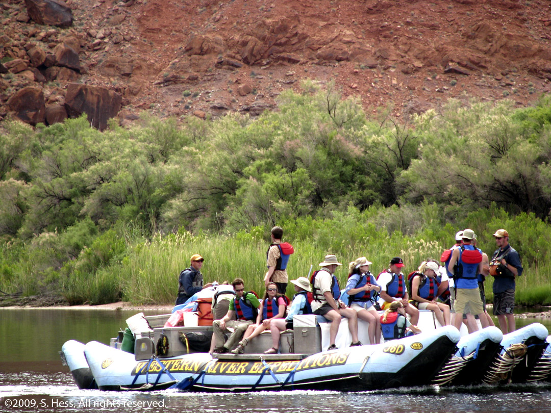
Rafters setting off from Lees Ferry on a trip down the Colorado River
picture by Susie
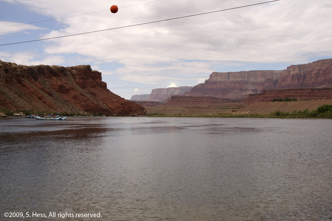
A view down the Colorado River from Lees Ferry
Along the Route to the North Rim
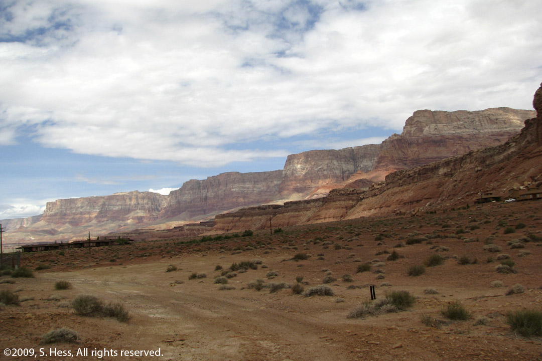
Vermillion Cliffs (picture by Susie)
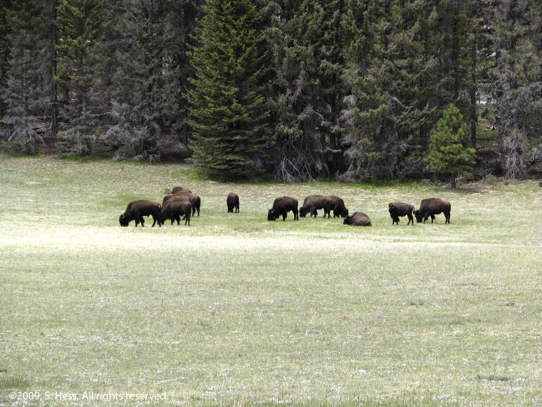
Bison grazing on a high meadow (picture by Susie)
North Rim of the Grand Canyon

left, picture by Susie
Roaring Springs Canyon
Seen On The Road (and bought by Susie)

A new Storyteller Doll for Susie's collection... I doubt she is done buying yet.