
Summer 2011
Diamond Lake, OR/Crater Lake
1 July 2011
Local Map
Click on pinpoints for local information
Photographs and Commentary
Click on picture to enlarge
A very cold night and morning. We got up this morning with temperatures in the low 30s but the clear blue skies and bright sunlight gave us hope for a warmer day (the weather forecast said it will be in the low 70s).
This past winter's weather in the Crater Lake area will also force a change in our plans. Strong storms coming in from the Pacific dumped 649 inches of snow in the park (equivalent of 1.78 inches every day for a year). The heavy snow has delayed the opening of the East Rim Drive until at least mid-July. The boat tours on the lake are also not scheduled to operate until the same time. We had planned to drive or take the trolley tour around the rim drive. However, only the West Rim Drive is open and that limits the drive to less than a third of the rim.
The North Entrance is located a little over three miles from Diamond Lake RV Park. As we cleared the gate we started to climb. The most obvious thing we noticed was the amount of snow left on the side of the road and amongst the trees. We thought Yellowstone had a lot of snow remaining, but this was even more. It is not hard to understand why the East Rim Drive is still closed. On our way out of the park, through the South Entrance, we stopped at the Annie Creek Gift Shop. I overheard one of the employees tell a customer that when he arrived in May, the building was totally covered by snow.
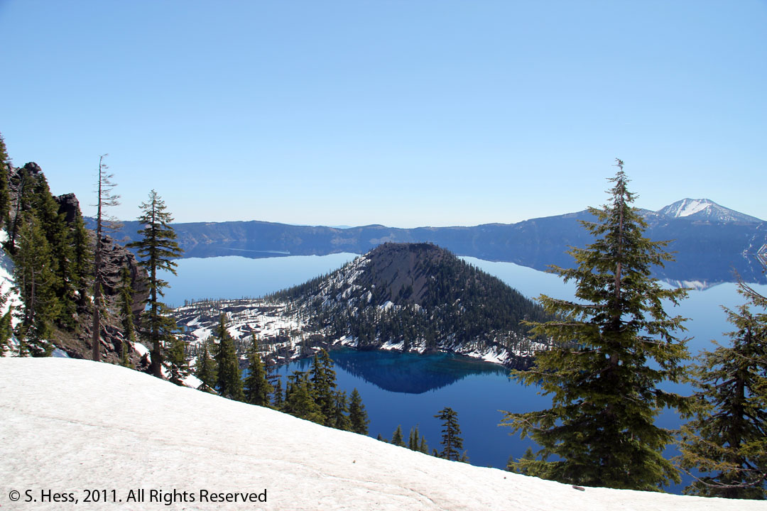
The first thing you encounter driving south from the North Entrance is the Pumice Desert. Ash lies 50 feet deep in this area and it has very little vegetation. There is water underlying the ash but few nutrients to sustain the growth of trees and shrubs. As we continued south on the North Entrance road we came to the junction with the Rim Drive at about 7,000 feet. We now continued on the West Rim Drive stopping at a number of overlooks to view and photograph the lake and its most obvious feature, Wizard Island. From our first view of the lake just below the junction, all you could see was jaw dropping vistas. Susie was absolutely awed by the sights and was nearly in tears. We both agreed that this was one of the most beautiful places we had visited in the past several years.
After completing our abbreviated tour of the Rim Drive, we took a few side trips along the Rogue River, including waterfalls, the Gorge and something we have never seen before, a Natural Bridge formed out of old lava tubes through which the river flows.
Even though we were unable to do a complete drive around the Rim Drive, we considered this one of the best days we have had thus far on the trip. The weather was near perfect, warm sun, no clouds and very little haze... now if we could get more of the same.
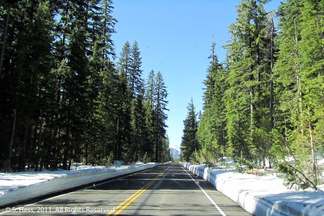
This was the view a few minutes after leaving the North Entrance
Picture by Susie
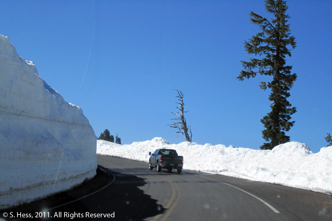
Susie took this picture to give a perspective on the snow depth. That is a full size truck like our, the snow on the left of the road is more than double the height of the truck. I estimate it at about 15 feet in depth.
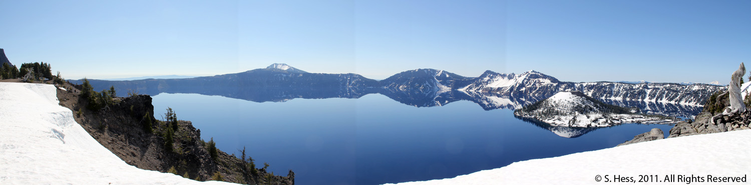
This panorama was shot from near the junction of the North Entrance Road and the Rim Drive
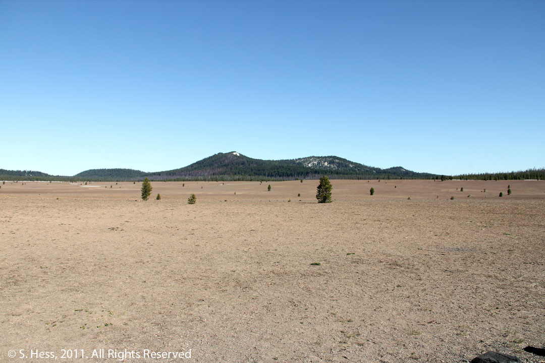
Pumice Desert
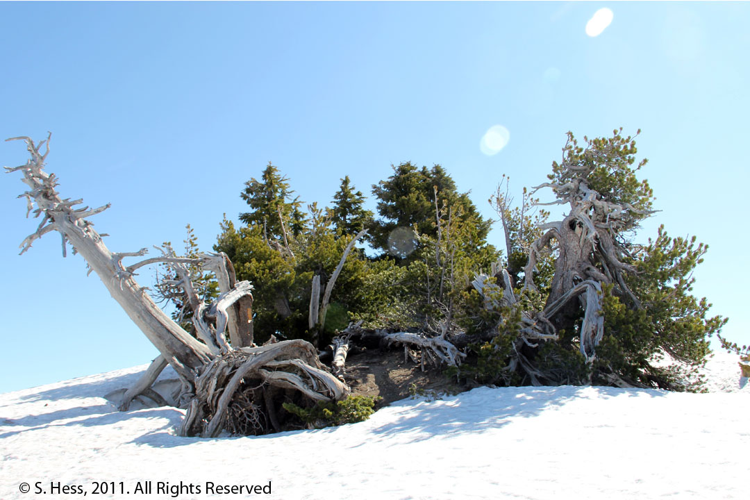
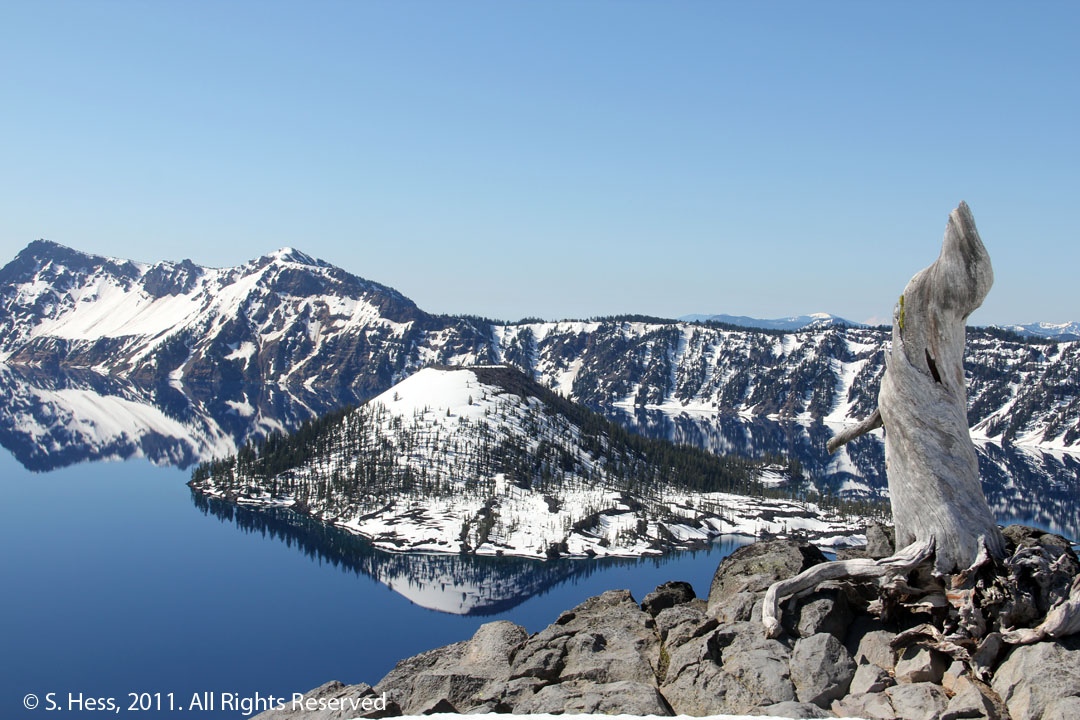
Gnarled trees on the crater rim
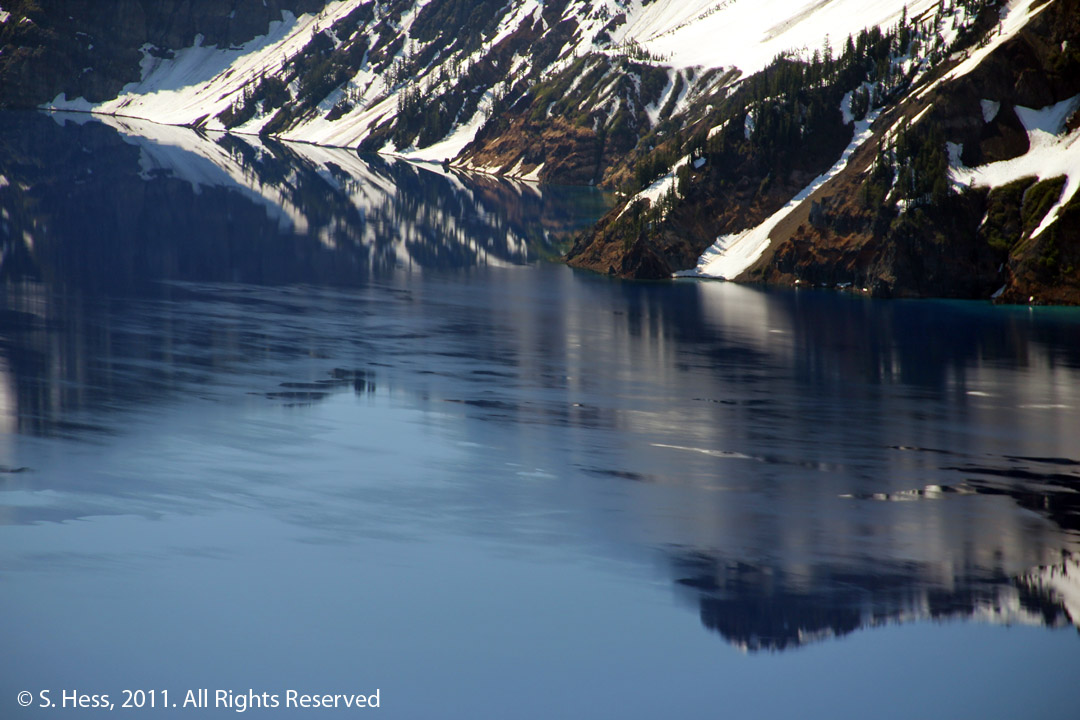
A thin layer of ice is still floating on the lake. This picture was taken on July 1st!
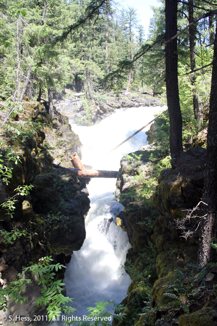
Rogue River Gorge
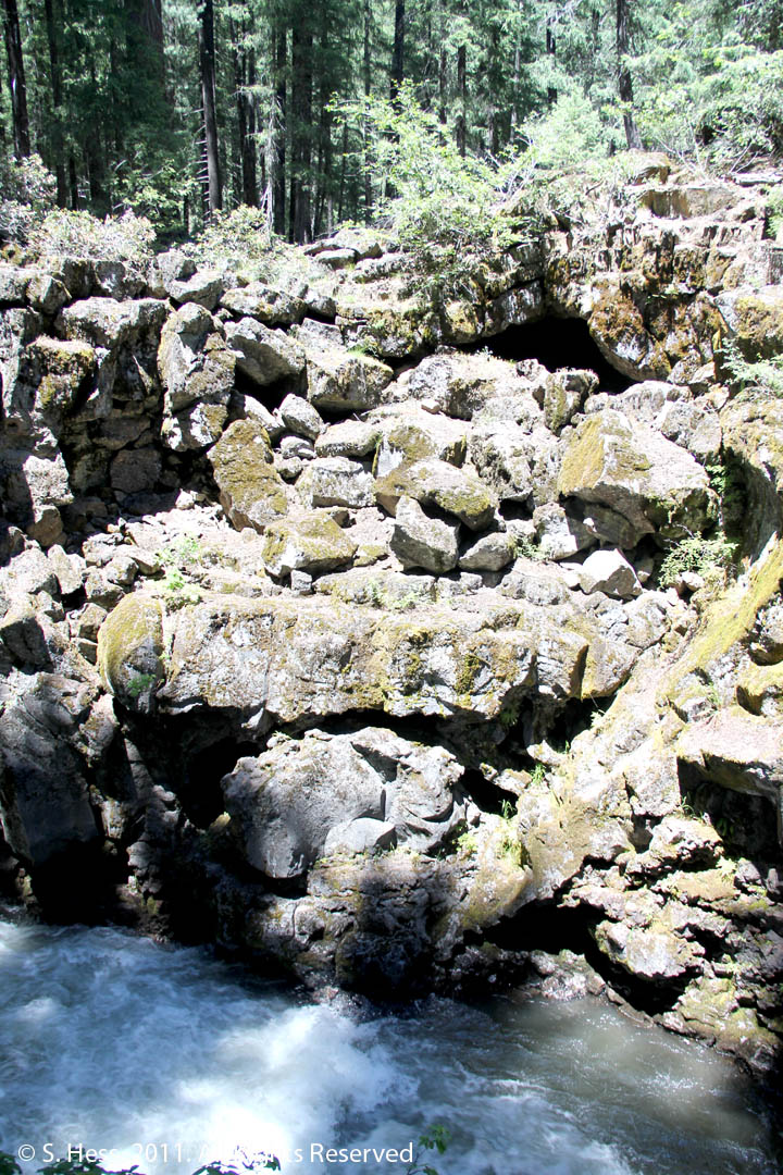
On the top right of the picture is a semi-circular opening that is a partially collapsed lava tube. Just above the water line in the center of the picture is a light gray "rock" that is actually a lava plug in a lava tube.
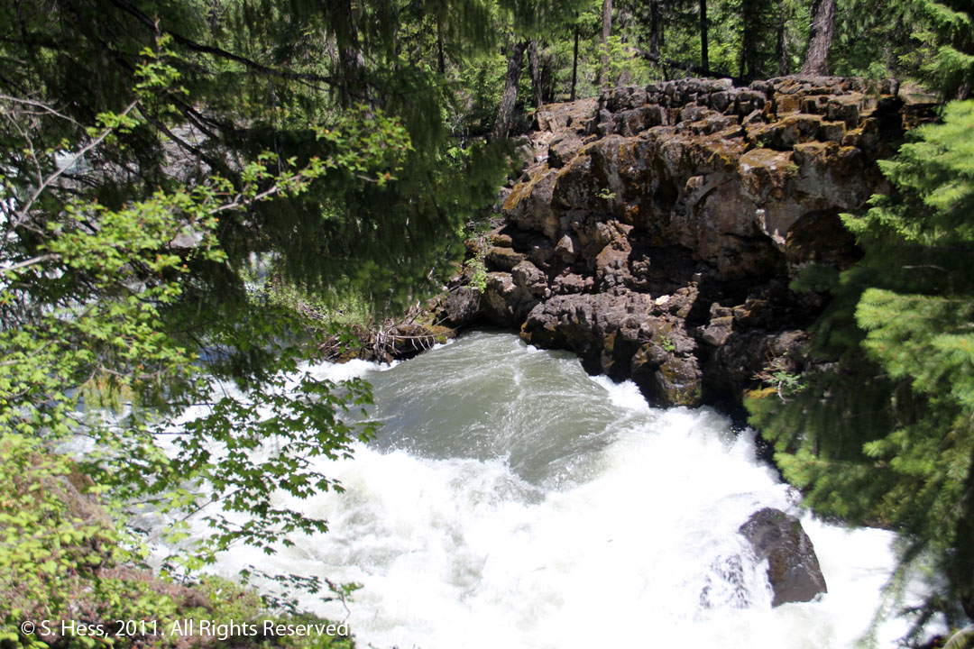
This is called Natural Bridge. A lava dam blocks the river so most of the water is diverted into a lava tube about 200 feet upstream. This is the discharge end of the tube. When the river runs low, all of its water goes "under" the bridge.
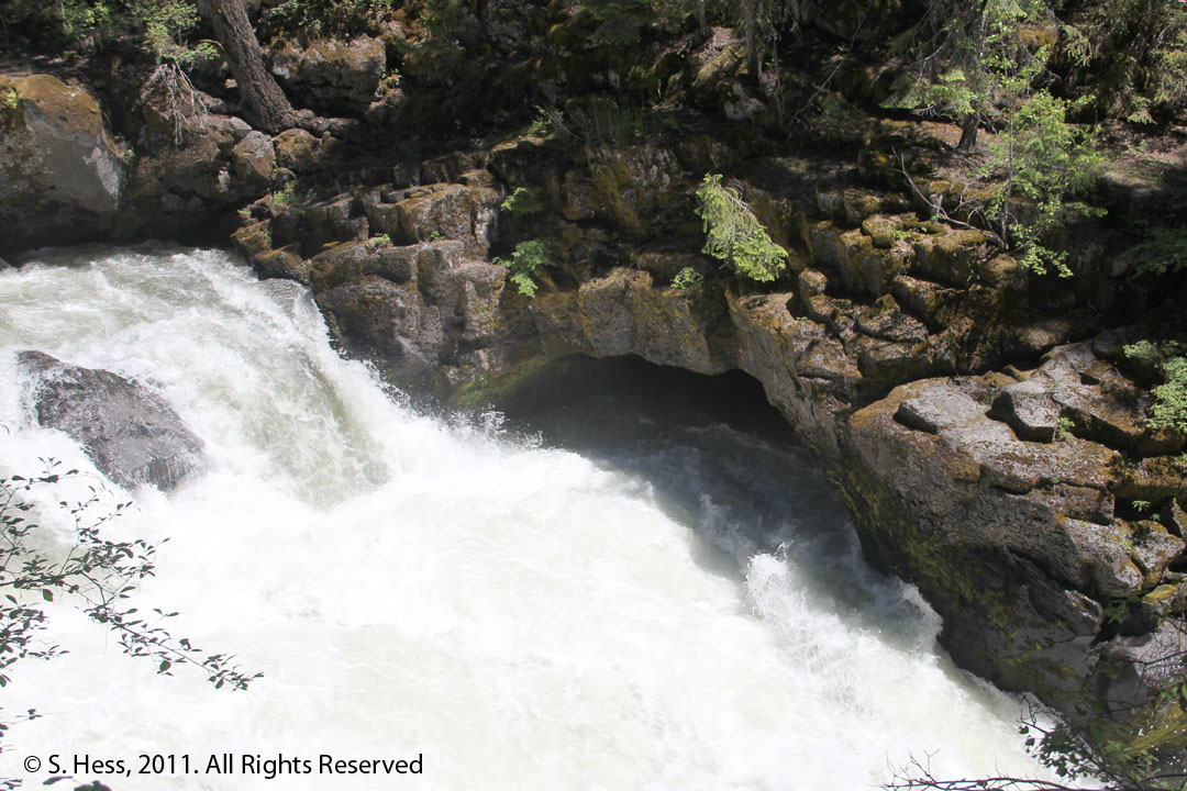
The river water enters this lava tube, circulates and comes out.