Alaska 2008
Tok, AK to Haines Junction, YT
26 July 2008
Route Map
Destination Map
Route Information
City/Town |
Points of interest |
Distance From |
Miles/Km |
Waypoint |
State/ |
Highway |
|---|---|---|---|---|---|---|
| Tok, AK* | Tok RV Village | Home Haines Junction |
6508/10413 289/462 |
63.334 N 142.964 W |
AK |
AK 2 (Alaska Highway) |
| Tetlin Junction, AK* | Home Tok Haines Junction |
6520/10432 12/19 277/443 |
63.311 N 142.602 W |
AK | AK 2 AK 5 (Taylor Highway) |
|
| Northway Junction, AK* | Home Tok Haines Junction |
6556/10490 48/77 241/386 |
63.011 N 141.802 W |
AK | AK 2 | |
| Border City Motel/ Scottie Creek Services* |
Home Tok Haines Junction |
6592/10547 84/134 205/328 |
62.670 N 141.062 W |
AK | AK 2 | |
| US/Canada Border | Home Tok Haines Junction |
6597/10555 89/142 200/320 |
62.615 N 141.000 W |
AK/YT | AK 2 YT 1 (Alaska Highway) |
|
| Beaver Creek, YT* | Home Tok Haines Junction |
6618/10589 110/176 179/286 |
62.367 N 140.869 W |
YT | YT 1 | |
| Koidern, YT | Home Tok Haines Junction |
6651/10642 143/229 146/234 |
61.984 N 140.491 W |
YT | YT 1 | |
| Kluane Wilderness Village, YT (closed/out of business?) |
Home Tok Haines Junction |
6699/10718 191/306 98/157 |
61.582 N 139.381 W |
YT | YT 1 | |
| Burwash Landing, YT* | Home Tok Haines Junction |
6717/10747 209/334 80/128 |
61.371 N 139.116 W |
YT | YT 1 | |
| Destruction Bay, YT* | Home Tok Haines Junction |
6732/10771 224/358 65/104 |
61.249 N 138.798 W |
YT | YT 1 | |
| Haines Junction, YT* | Kluane RV Kampground | Home Tok |
6794/10870 289/462 |
60.753 N 137.510 W |
YT | YT 1 |
| *Fuel Available |
Photographs and Commentary
Click on pictures to enlarge
When we got up this morning, I was really not looking forward to the drive. Today, we start backtracking on the Alaska Highway towards Watson Lake, YT. This first leg covers the segment of the highway we drove through three weeks ago. At that time I labeled it as one of the worst roads we traveled. That label still holds for some segments. Three weeks ago the stretch from the border crossing to Tok was one seemingly continuous series of frost heave bumps. To our surprise, most of the bumps had been repaired. There were two major single lane work zones in the first 90 miles and while they delayed us for about 10 minutes each, they were not really bad. It had been raining during the night and we hit a few showers this morning. The rains turned the two work zones into mud holes. Driving through them threw mud on the underside of the truck and trailer. This mud hardened into a cement like consistency that I had to knock off parts of the trailer in order to drop the front trailer jacks. The truck will have to wait until we get home to get power washed (unless we can find a power wash in one of the campgrounds we are staying in).
The first 110-120 miles in the Yukon were, in a word, awful. Whereas Alaska made major progress on the highway in the three weeks since we passed, Yukon seemed to have been satisfied putting up flags and warning signs. I don't believe they repaired much of anything in that stretch of road. Every time you start accelerating up to speed, you have to slow down. If you fail to slow down, you could wind up being airborne... which we did a couple of times. When we stopped for lunch, Susie and I were afraid to open the trailer because we didn't want to see any more shattered dishes on the floor... we didn't. The major road construction project on the shores of Kluane Lake was not working today so we didn't have to wait for a pilot car escort. Once we were past the construction area, the road conditions improved significantly and we were able to maintain the speed limit all the way to Haines Junction.
This stretch of the Alaska Highway has limited services. When we were driving on this stretch in 2005, we stopped for a night at Kluane Wilderness Village, a large facility that had a gas station, repair facilities, a restaurant, motel and campground. The place was quite busy. When we drove by here three weeks ago, we were surprised to see that the entrances were barricaded. There was another campground and service station in Koidern that seemed to have been busy in 2005 and it was now shut down. This leaves a large gap in service facilities in the first 120 miles of the highway in the Yukon. If you don't fuel up in Border City, AK or Beaver Creek, YT, you could be sitting on the road with an empty fuel tank. We had fueled up in Tok and really expected to see a service station around 150 miles into the trip. We had noticed that Kluane WIlderness Village was closed on the way up to Alaska so I thought I could get fuel at Koidern (I didn't notice that it was closed). We wound up going into Burwash and I had less than a quarter of a tank of fuel. I was not concerned because I carry a 2.5 gallon can of diesel in the truck. Most people who are experienced with the Alaska Highway and the other roads in this part of the world carry one or more cans of fuel... just in case.
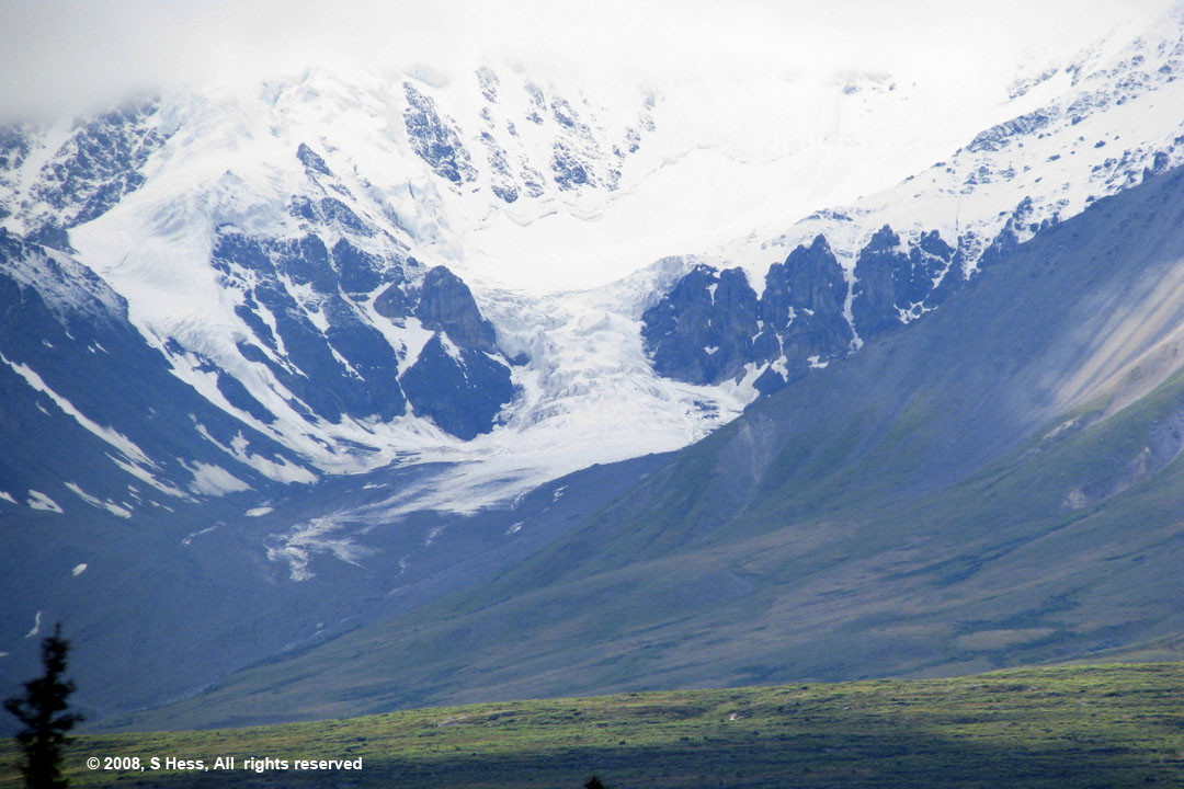
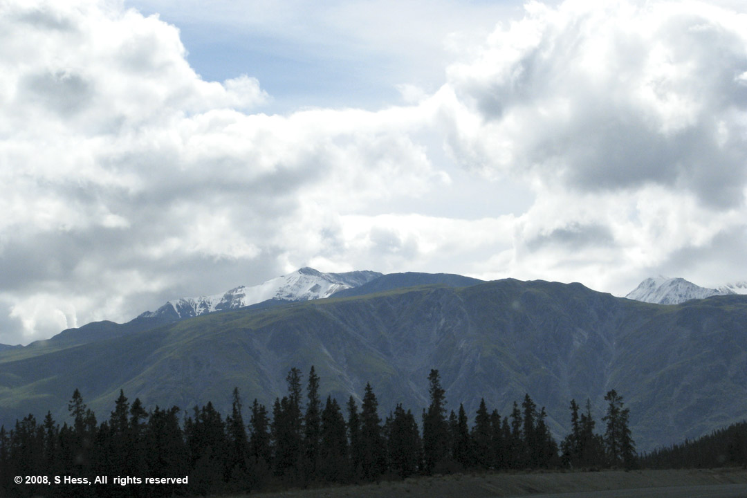
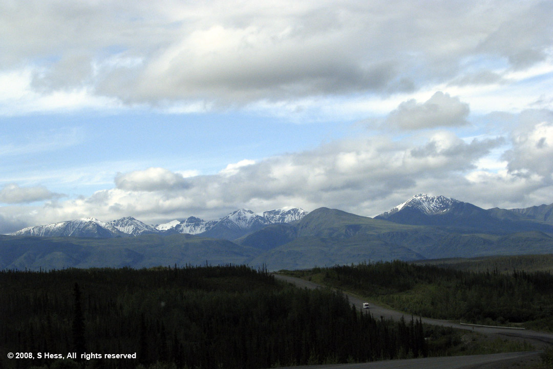
This section of the Alaska Highway is really beautiful. You have snow covered mountains within sight almost constantly. There are a number of beautiful lakes and rivers that we passed on the way. The weather today also made the view better because for the first time in a while we had sunshine. The sunshine made the colors of Kluane Lake really stand out. When we were northbound, the clouds made the water look dark green or gray. Today Kluane displayed a beautiful aquamarine color.
We saw 60° today for the first time in a long time. it was warm enough for us to leave the trailer door open until after dinner. Of course, mother nature likes to play with us so she gave us some fairly high winds as we were driving causing our fuel consumption to go up. For a little more fun, tonight the forecast is for a low of 35°. Hopefully, the weather will continue to warm up and stay sunny, but I doubt it. I also suspect that I will be complaining how hot it is when we get closer to home.
Alaska Highway Scenes
Pictures by Susie

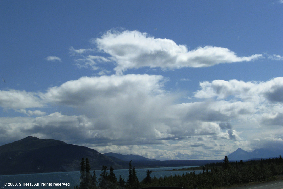
Kluane Lake