Summer 2011
Portland/Fairview, OR
25 June 2011
Local Map
Click on pinpoints for local information
Photographs and Commentary
Click on picture to enlarge
The plan for today was to go to Portland and walk around the Saturday Market (a craft fair) and bit of the historic district. While it was quite cool this morning, the skies were relatively clear, so we decided to go to Mount Saint Helens, about two hours north of Portland. If we had time when we got back in the Portland area, we could still get to the Saturday Market.
The first part of the trip to Mount Saint Helens is all Interstate driving. Driving I-205 we crossed the Columbia River into Washington and picked up I-5 a few miles north of Vancouver, WA. I-5 parallels the Columbia River until just south of Longview, WA. Ten miles north of Longview, at Castle Rock, we leave the Interstate and take Highway 504 for about 50 winding miles to Johnston Ridge Observatory.
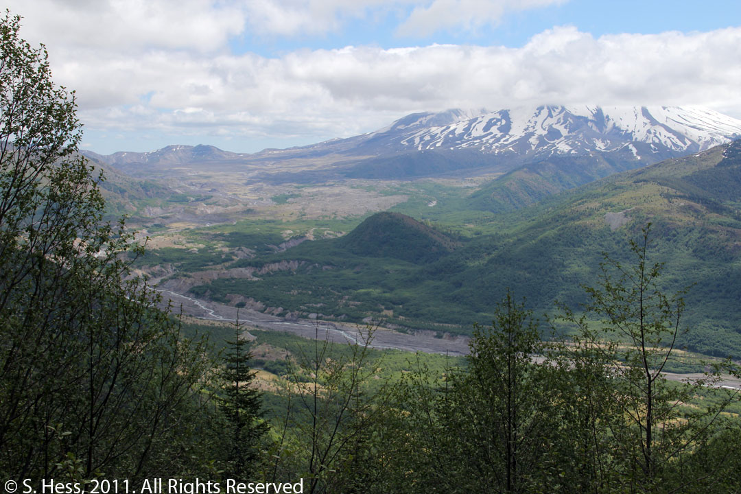
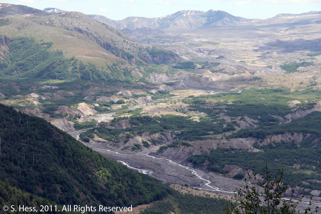
The observatory sits on a ridge about 5 miles across valley of the North Fork Toutle River from Mount Saint Helens. The clouds kept us from seeing the top of the crater clearly, but we got enough of a view to appreciate the power of the 1980 eruption. The initial landslide, which removed about 1/3 of the peak, was followed by a mud flow. The combination covered the river valley with several hundred feet of debris. Today, the river is cutting a channel in the debris, but the impact of on the valley is still very obvious. From the observatory you can see the hillsides where the blast knocked down the trees. Over the last 30 years much of the blast zone has been restored as new trees were planted and other vegetation took hold, but there are still plenty of hills where the toppled tree trunks are laying pointing away from the mountain. Mount St. Helens is an awesome site and we were glad we decided to make the trip.
We returned to the Portland area in time to take in the Saturday Market. What we thought would take a good part of the morning to walk through, took us less than an hour. While there were some interesting booths, as a whole it was a bit of a disappointment. We have been to a number of craft fairs over the past few years and this one will not rank high on our list.
Mount Saint Helens
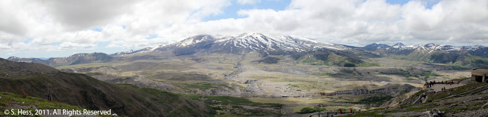
Mount Saint Helens, nearly forty miles distant, as viewed from the Visitors Center
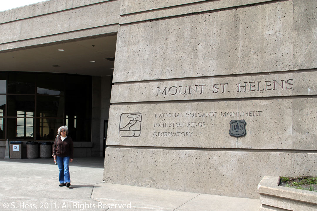
Susie standing in front of the Johnston Ridge Observatory
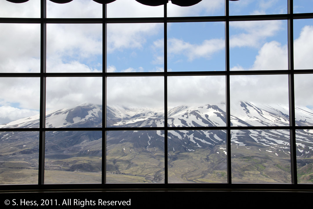
The Observatory theater shows an 18 minute film on the 1980 eruption. When the film ends, the screen is raised and curtains opened revealing this view of the mountain.
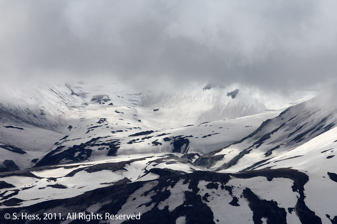
The crater is partially obscured by the clouds, but you can just make out lava dome that is continuing to grow
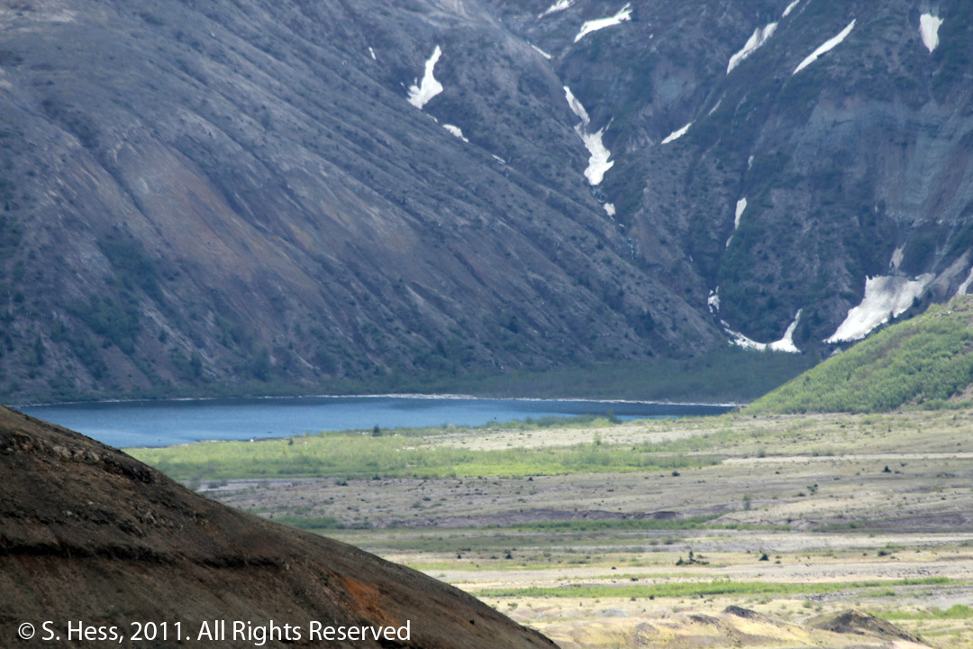
View of Spirit Lake which was partially filled with tree trunks and mud
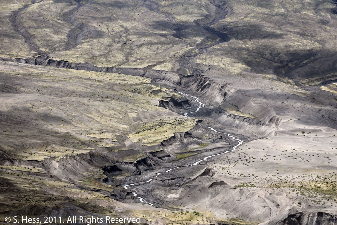
Drainage from Mount Saint Helens is cutting new channels through the debris caused by the landslide and mud flow
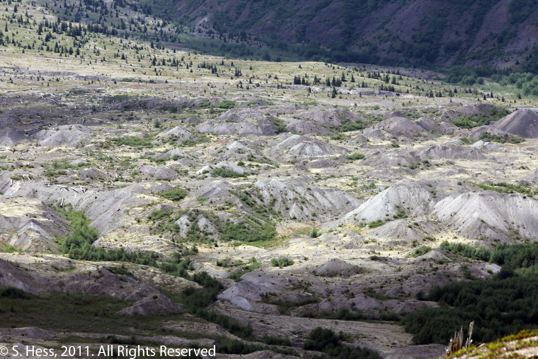
Small hills, called hummocks, were formed in the river valley
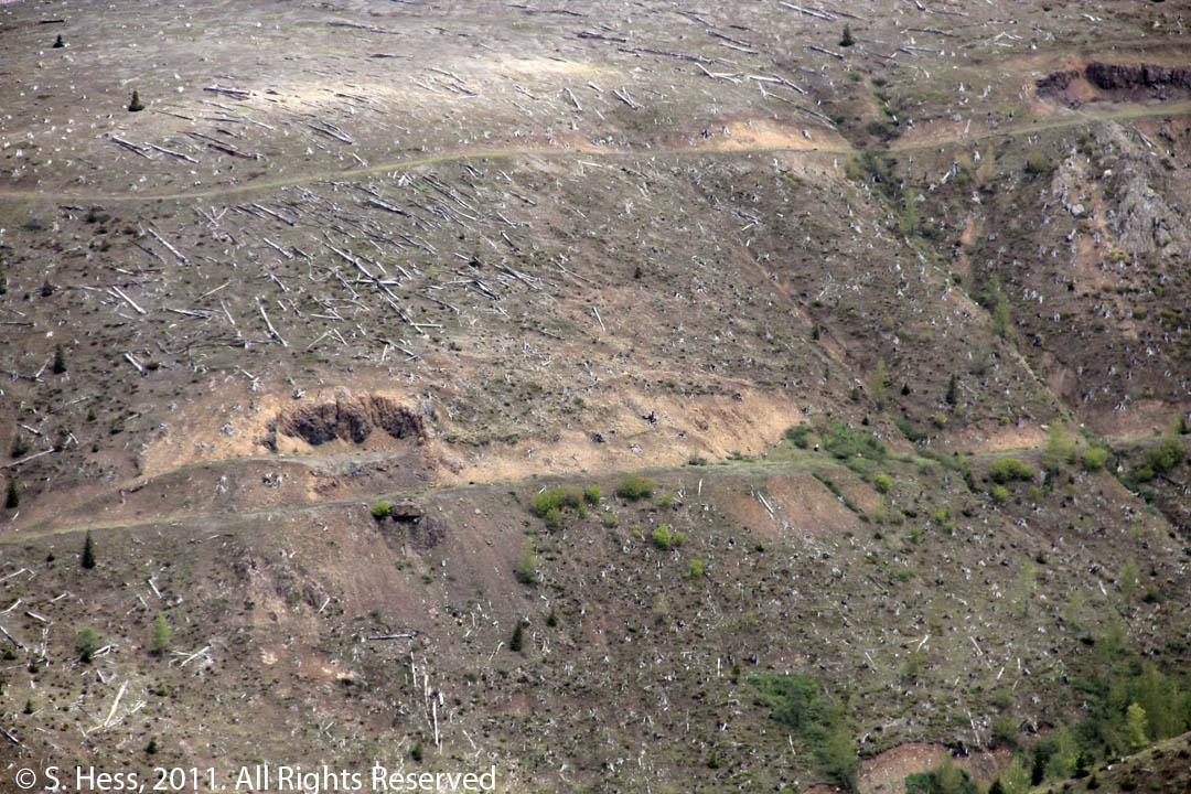
Tree trunks lay where they were felled by the blast. This hill is on the opposite side of Johnston Ridge from the mountain.
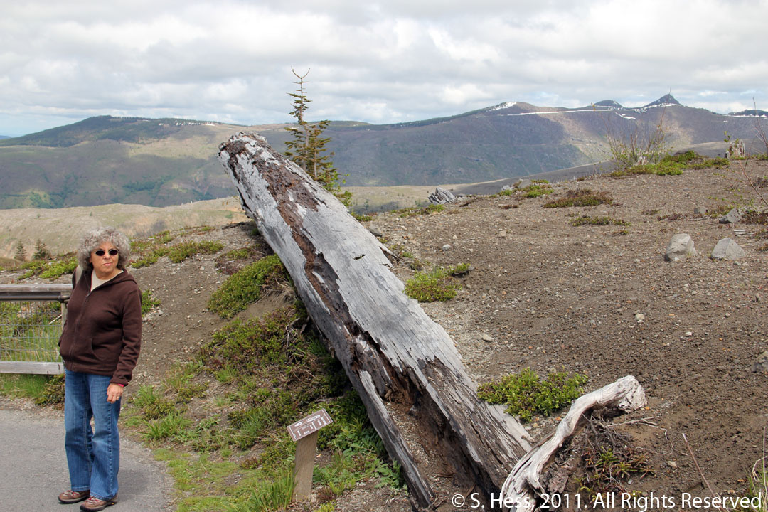
One of the trees knocked down on Johnston Ridge