
Summer 2011
Portland/Fairview, OR
24 June 2011
Local Map
Click on pinpoints for local information
Photographs and Commentary
Click on picture to enlarge
We got up this morning at the crack of dawn. Well, not quite... we got up to the ringing of both our phones starting at 5am PDT from friends on the East Coast who forgot that we were on the West Coast. It happens every year so we are used to it. After the third call we just gave it up and got up. I wanted to check the trailer tires while they were cold and inflated them as necessary. After the blowout last summer that caused a bit of damage to the trailer. I do not want to take a chance of repeating that bit of excitement.
The weather this morning was partly cloudy and we decided to go to Mount Hood and Multnomah Falls, a loop of about 150 miles. We left the RV Park and headed for US 26, Mount Hood Scenic Byway which took us to the Mount Hood area. We got off the Byway at the exit for the Timberline Lodge, a historic landmark. The road to the lodge was very good considering it twists its way a few thousand feet up the mountainside to the Lodge. When we started up the mountain, the summit was clear but clouds were gathering. We were lucky and got a few pictures of the summit before parts of it were in the clouds. By the time we arrived at the Lodge parking lot, the temperature dropped to a brisk 41 degrees, something we were getting used to on this trip. The parking lot was packed with cars belonging to skiers, snowboarders and climbers. The lifts were running and there were quite a few people on the slope for a weekday. This is summer, isn't it?
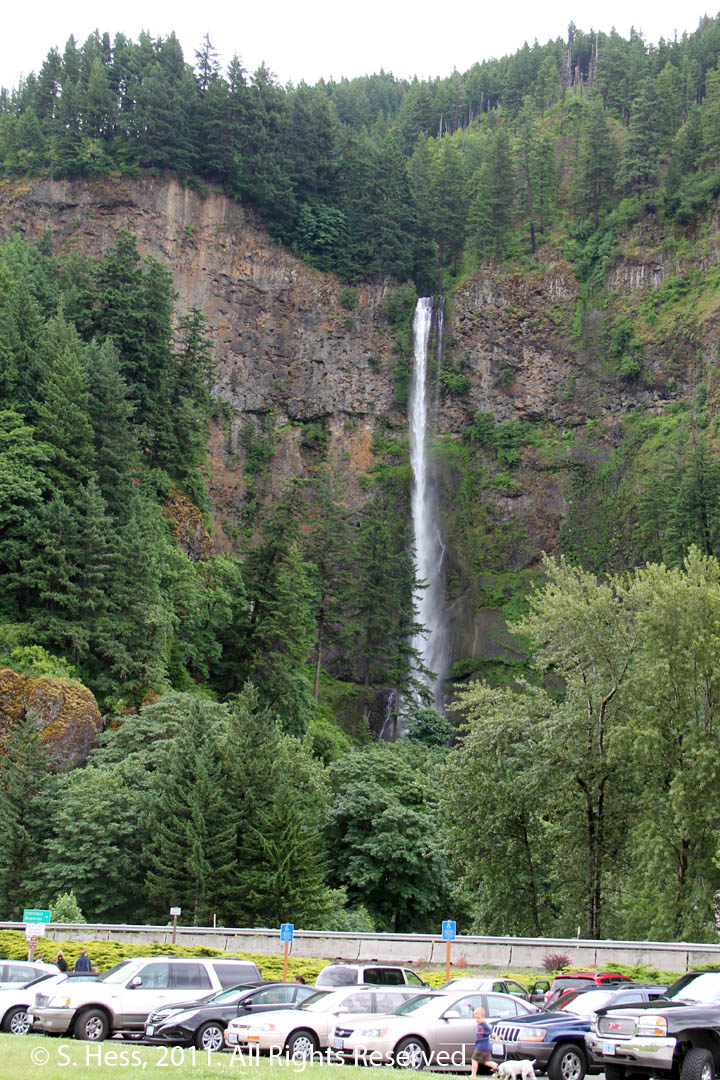
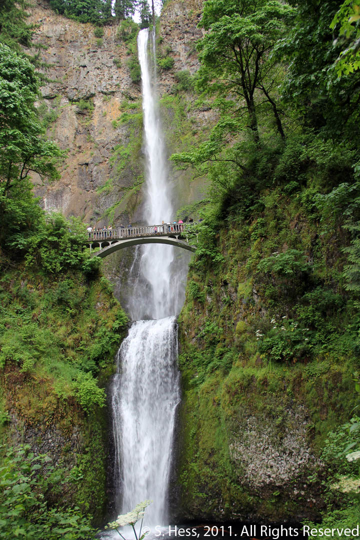
We drove back down the mountain and rejoined US 26 for a few miles and then continued north on Oregon Route 35, also a part of the Mount Hood Scenic Byway. This route took us around the mountain and up to Hood River where we turned on to I 84 for about 30 miles to Multnomah Falls, which at 620 feet is the second highest year-round waterfall in the US (for the curious, the highest is Yosemite Falls). The parking area for the Falls is the median between the opposing lanes of I-84. I guess when you are hemmed in by a rock wall on one side and a river on the other, you adapt. We viewed the falls from the level of Multnomah Falls Lodge, another historic landmark. There is a path that will take you to a bridge overlooking the Falls (see pictures) and continues on to the top of the Falls. I had thought about climbing to the bridge level, but my knees gave me some hints that I might regret that decision. Still it is a beautiful waterfall. US 30 West from Hood River is another scenic way to get to Multnomah Falls, but it is a narrow and much slower trip.
After viewing the Multnomah Falls, we headed back to the RV Park, arriving in mid afternoon. Our plan was to relax this afternoon... and we did.
Mount Hood
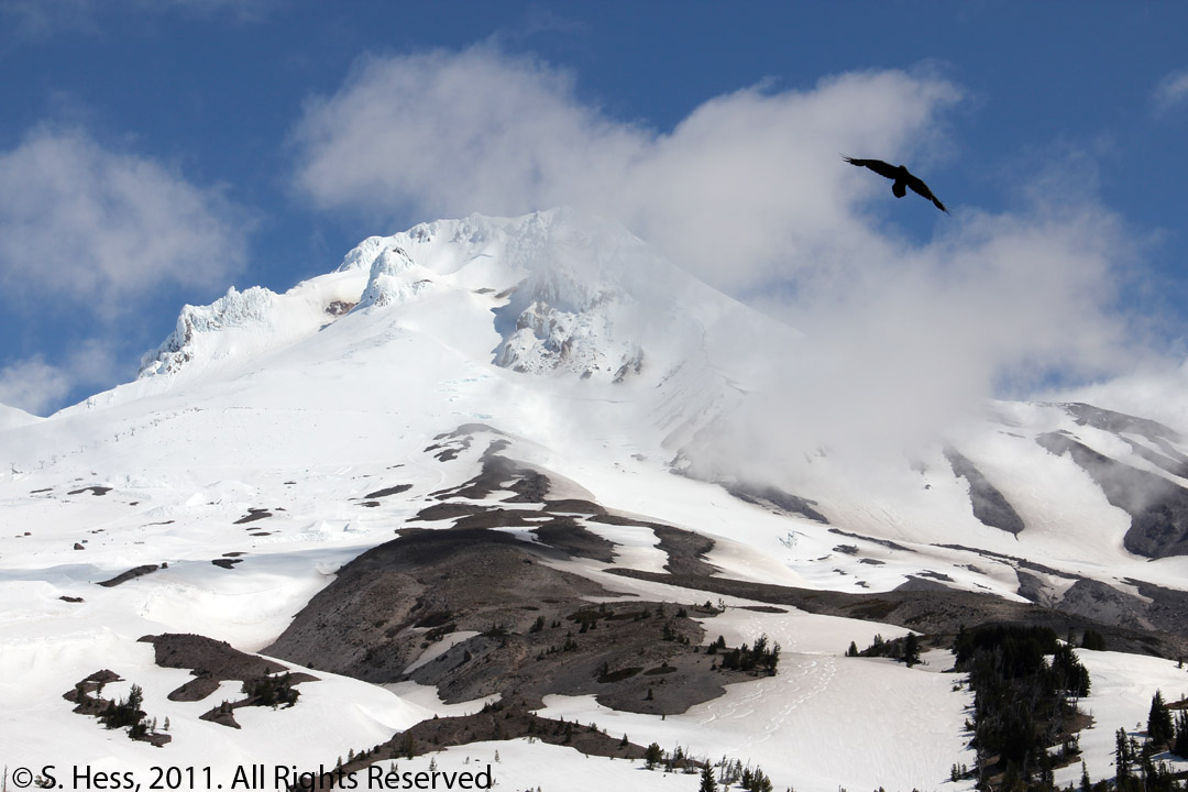
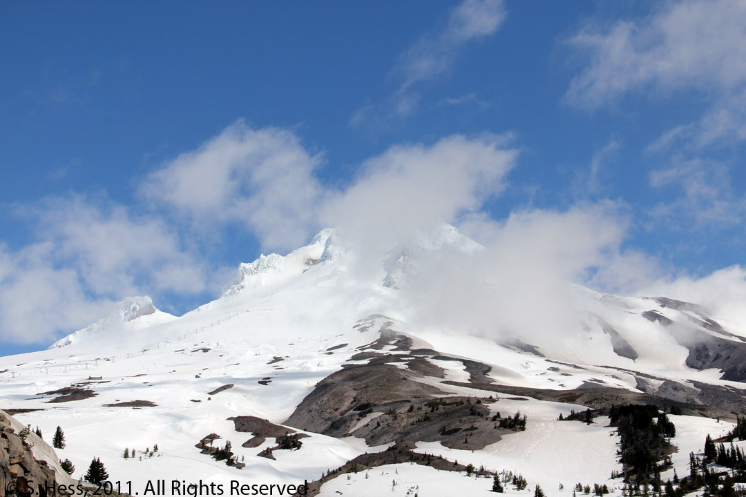
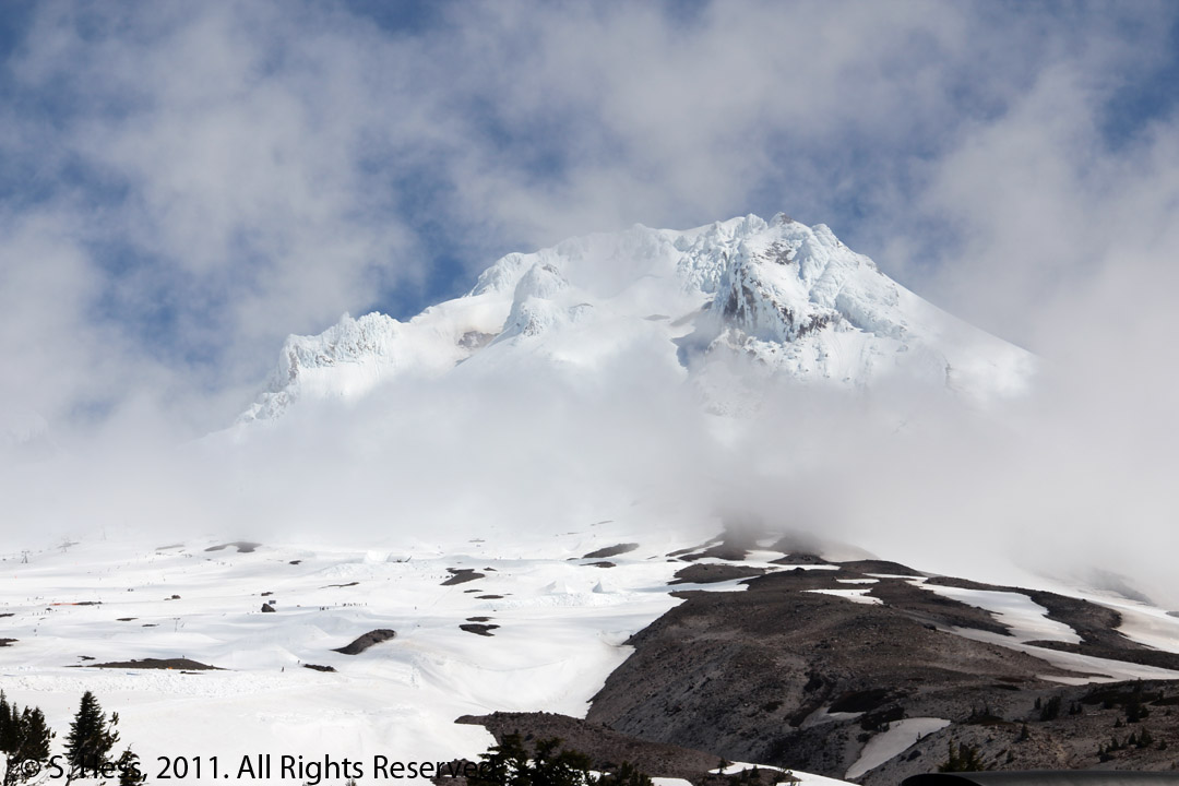
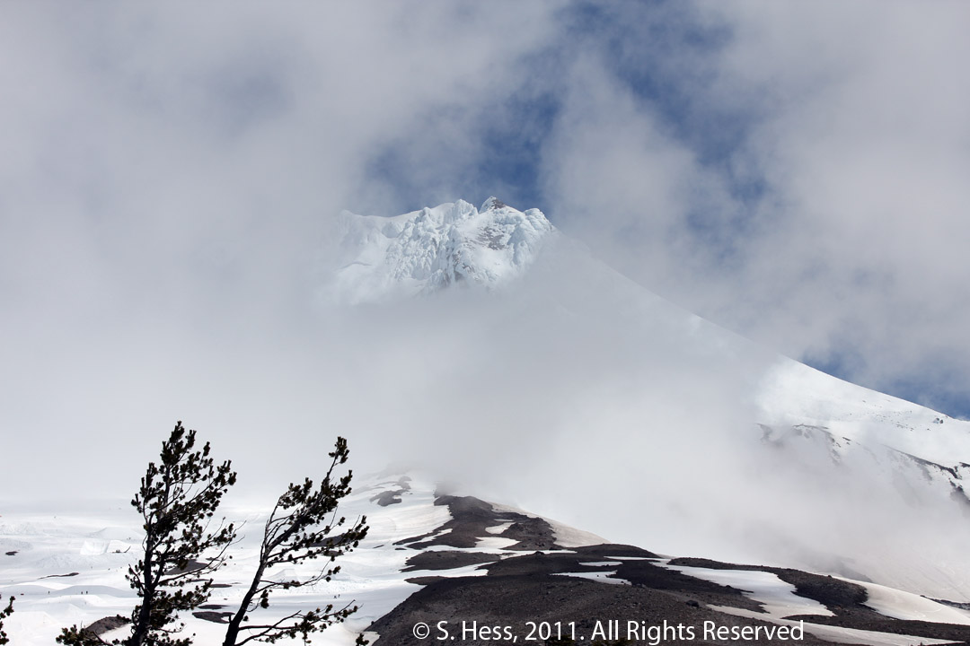
These pictures were shot over a period of less than half an hour. In that time the summit was relatively clear of clouds for a while and almost completely obscured a short time later (clockwise from top left). When we were driving on OR Route 35 about 45 minutes after the last of these pictureswas taken, we could see the entire summit in the clear. The raven in the picture in the upper left flew into the frame just as I was ready to take it. Of course I obliged and included him/her in the shot.
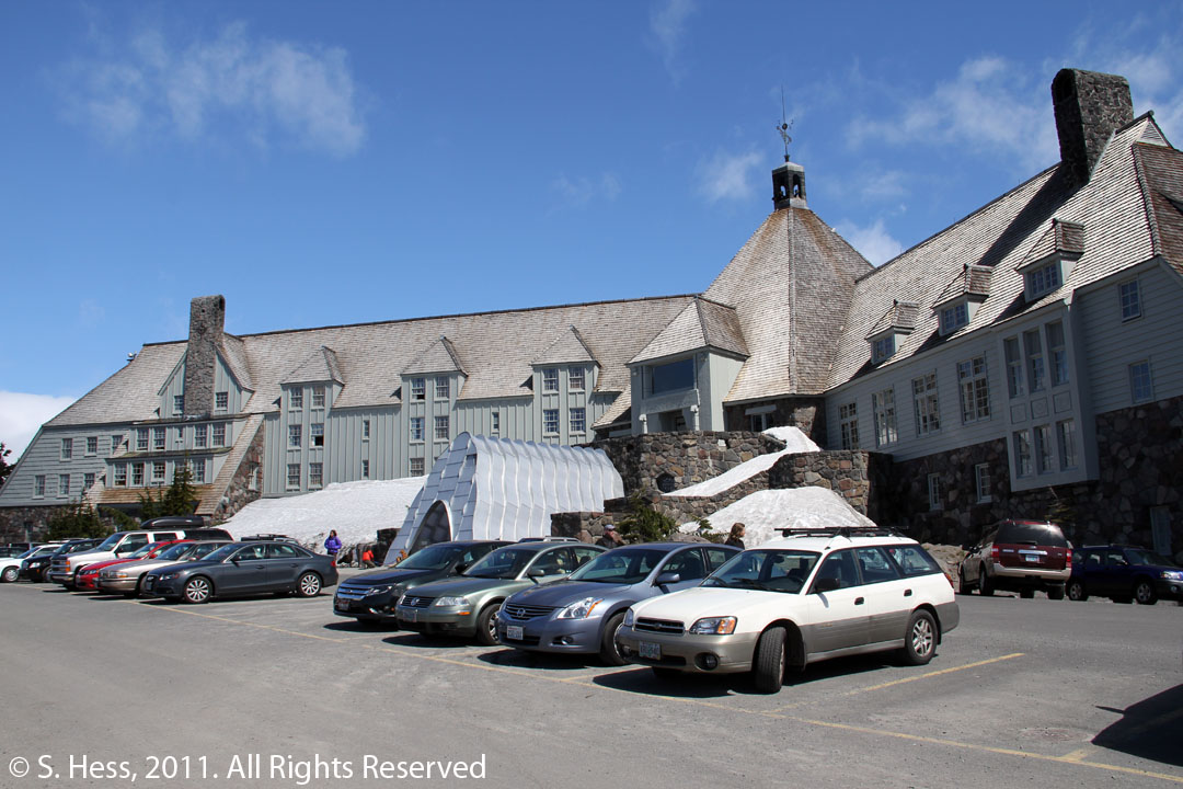
Timberline Lodge
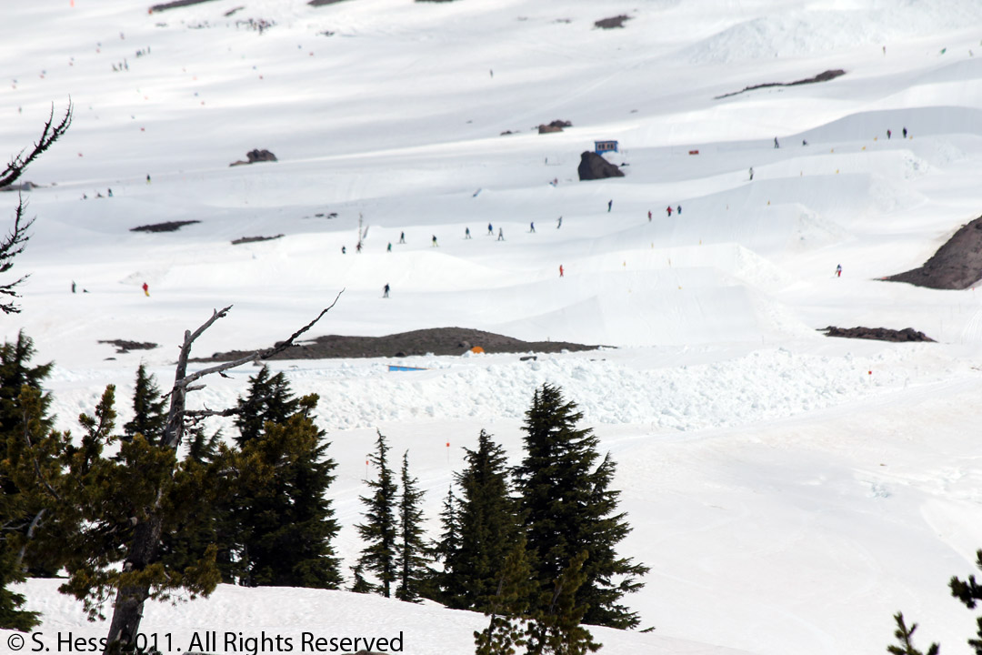
Summer Skiing
Multnomah Falls
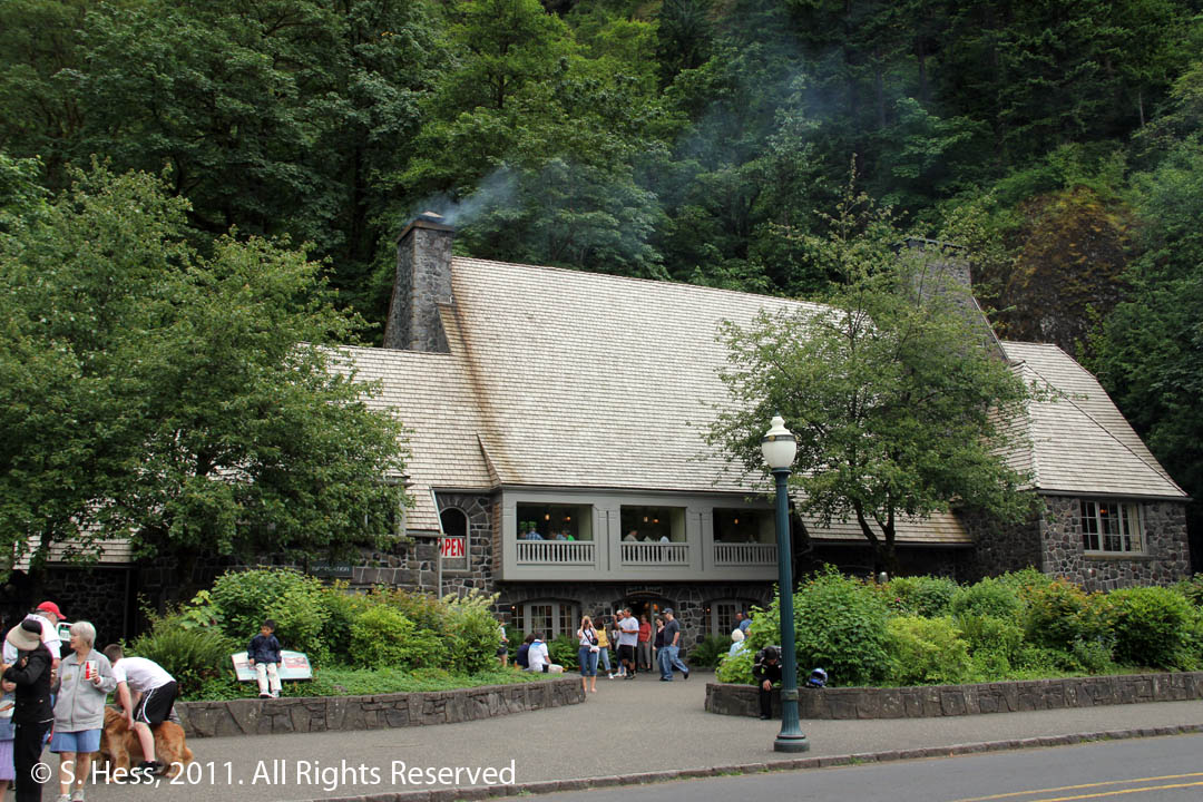
Multnomah Falls Lodge
Left, View of Multnomah Falls from the parking lot. The eastbound lane of I 84 separates the lot from the Falls
Multnomah Falls
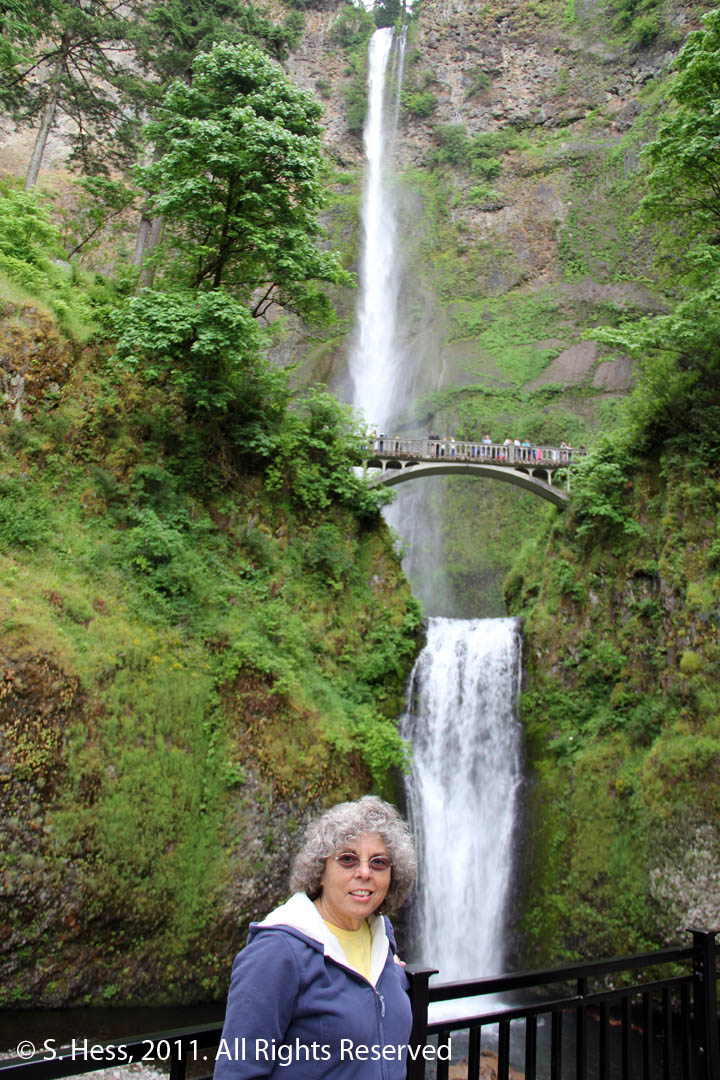
Susie at the Falls
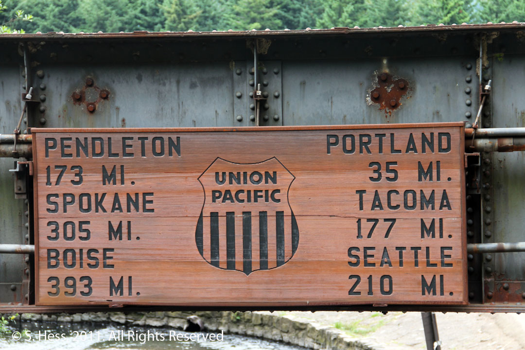
Sign on the Union Pacific Rail Road trestle showing distances from Multnomah Falls to cities on the route